 Ward Archer
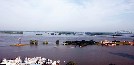
Mud Island is submerged under the Mississippi River during the flood of 2011.
Shelby County safety officials are preparing for potential flooding along the Mississippi River as waters here rise a foot and half each day, officials said.
Shelby County Office of Preparedness (SCOP) staffers checked water gauges Thursday and took pictures of areas likely to receive damage, according to a statement from the office.
The SCOP will keep Shelby County Mayor Mark Luttrell and city mayors apprised of the situation as it develops.
“Although we will likely face some challenges by the high water, Director [Dale] Lane and his staff at the Shelby County Office of Preparedness have reviewed their plans and are ready to coordinate the response by public works, law enforcement, fire, and emergency services bureaus across the county,” Luttrell said in a statement Thursday.
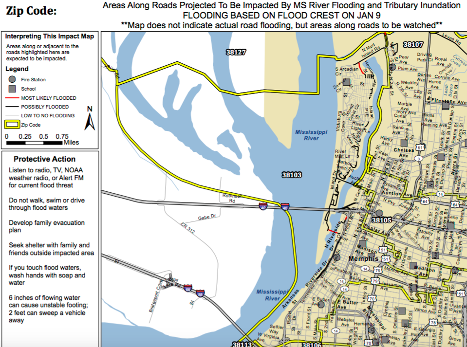
The SCOP and the University of Memphis created a map that shows anticipated damage in ZIP codes throughout the county. To see if your area might be affected, check the maps at the SCOP website.
 Shelby County Office of Preparedness
A map of the 38103 ZIP code shows where floodwaters may damage areas of Downtown Memphis.
So far no roads have been closed in the county. But on Monday, Second Street, between Whitney and Mud Island Drive, will be closed as will the access road to the Stiles Water Treatment Plant. Drivers should use Pear Avenue and Thomas Street as detour routes, according to Ken Johnson of the City of Memphis Traffic Engineering Department.
Should the SCOP activate the Emergency Operations Center, the National Weather Service, Tennessee Emergency Management Agency, MLGW, and other agencies will have representatives available to help those affected by floodwaters.
National Weather Service forecasters say the Mississippi River will crest at an estimated 42 feet by Saturday, Jan. 9. The crest was 48.3 feet when the flood of 2011 damaged neighborhoods in Memphis and Shelby County.
For more information about the flood response, go to www.staysafeshelby.us or call (901) 222-6700.


 Apple Maps


 Justin Fox Burks
  Justin Fox Burks
  Justin Fox Burks