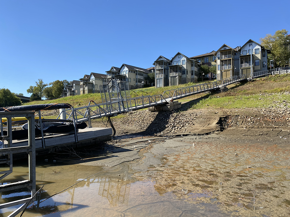
The boardwalk to Harbor Town Marina on Mud Island usually runs at a slight decline to the water from the parking lot near Cordelia’s Market. Today, the walkway slants at a precipitous angle, flat to the ground, down to the marina and its collection of yachts, cruisers, houseboats, and ski-boats, most of which are literally stuck in the mud. The Mississippi River is at its all-time historical low in Memphis — 10.75 feet below normal.
I’m meeting John Gary, one of Memphis’ preeminent river men. Gary’s been going out on the Mississippi since his boyhood, 50 years ago. He knows the Memphis section of the river like few others. We’ve been friends for many years.
“Over here,” he shouts. I see him approaching from the far end of the dock, where there appears to be at least a few inches of water, and where Gary’s 19-foot runabout is tied up.
“This is crazy,” I said.
“I’ve never seen anything like it,” he replies. “There’s a lot of beach out there where a river used to be.”

We climb into the boat and putter our way south, heading out of the harbor, past the Downtown skyline, past the exposed cobblestones, and past an ancient, long-hidden motorboat with its stern sticking out of the mud. Gary’s two dogs, Max and Lyon, are our happy passengers.
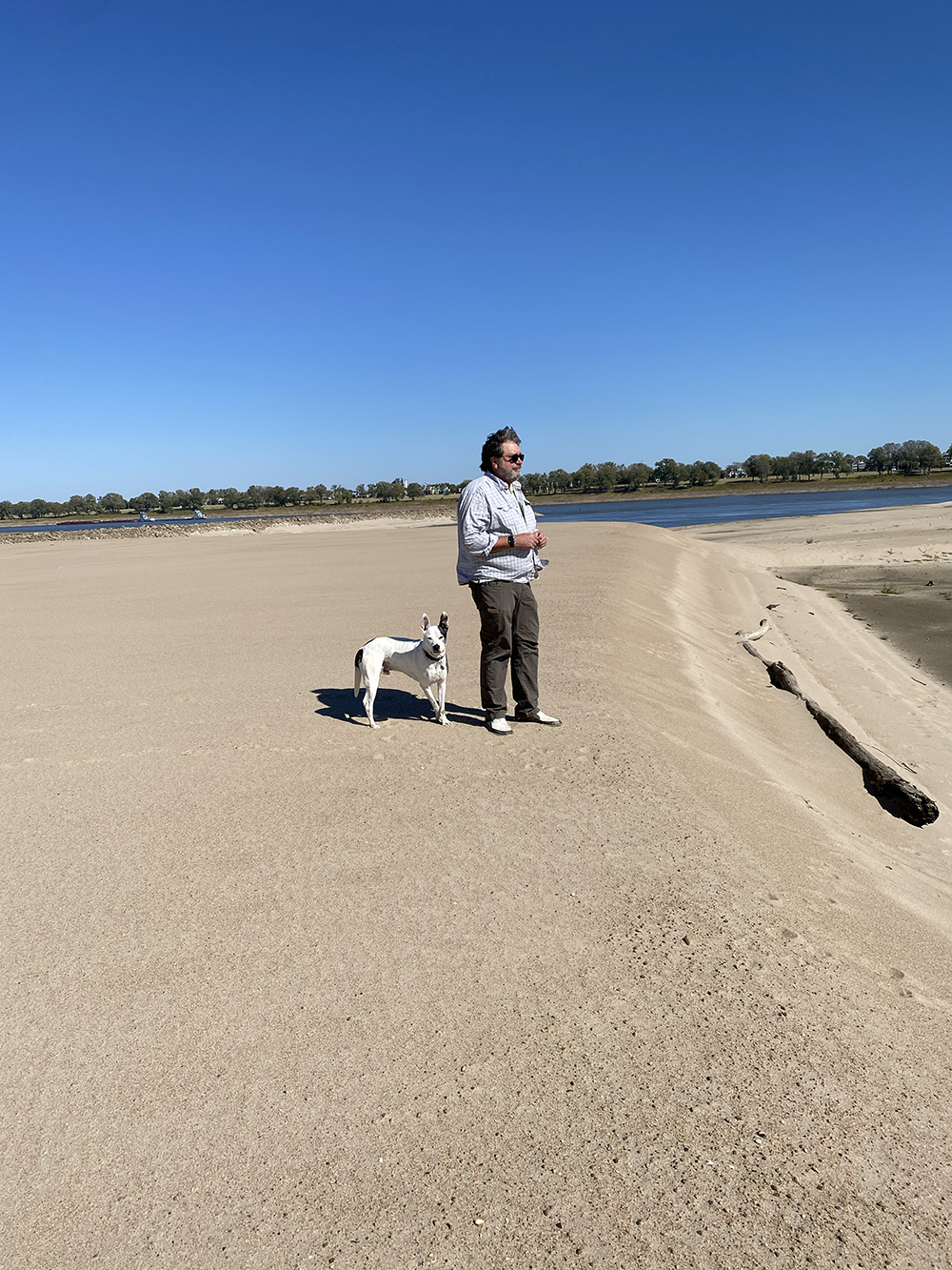
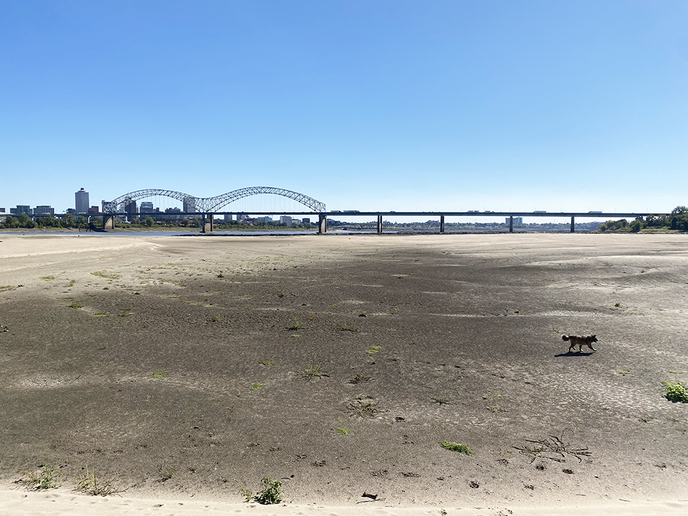
Once on the river, we turn north and motor briskly under the Hernando DeSoto Bridge. We’re going over to take a look at the Loosahatchie Bar (known by locals as Robinson Crusoe Island). It’s the island you see just north of the bridge as you cross into Arkansas. Well, it used to be an island. Now, not so much. What was once a river back-channel is currently a vast sandbar that connects the island to the mainland and reaches halfway across the river to Downtown.
Gary finds a good spot to stick the boat anchor in the sand and we tie off. The dogs run ahead, eager to explore this fresh Sahara, with its high white dunes and its deep dark pockets where the water lingered longest, now as dry as the gar and carp bones bleaching in the sun. Animal footprints remain in the once-muddy sand around the now-gone watering holes: great blue heron, coyote/dog, raccoon, even a large cat track or two. I take photo after photo, dazzled by the weirdness of standing on the bottom of the country’s biggest river.
After a while, we decide to motor upriver along Mud Island, where we pass a long string of barges that are running their engines at the precise speed needed to stay in place against the current. They are loaded with benzene (used to refine gasoline), ammonia, fertilizer, concrete, and other farm and industrial essentials.

Gary explains that the channel has narrowed so much upriver that only one barge can pass at a time. Barges coming downstream have the right of way, so upstream barges can often sit for hours a day, burning fuel, awaiting their turn. For the moment, this section of America’s supply chain is dead in the water. Results coming soon to a gas station or construction site near you.
We continue north until we reach the mouth of the Wolf River, which looks more like the Wolf Ripple as it splashes over rocks and mud, adding a temporary trickle to the Mother of Waters.
How long does this go on? How low can the Mississippi go? And as Mother Nature continues to show us new climate change tricks, is this something we can expect to happen more often? The immediate prediction is that we can expect the river to stay low for the near future, and possibly even drop further. Meaning we can expect a vital supply lane for the U.S. economy to continue to be slowed, at best.
Back at Harbor Town, we tie off Gary’s boat to the very end of the marina in a couple feet of water. As we survey the bent steel and broken boards of the marina’s structure, and the dozens of boats settled into the brown goo, it’s obvious that most of these vessels won’t be going anywhere for quite some time. For now, there is no joy in Mud Island. The mighty Mississippi has struck out.
