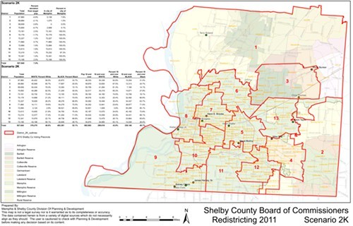
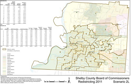
The Shelby County Commission’s search for viable and mutually agreeable district lines continues Monday, and two new versions of a single-member-district map will apparently be presented.
One, designated 2K, would seem to incorporate suggestions made at the last meeting by Commissioner Mike Ritz, who is keen on seeing firm dividing lines between areas now with in the City of Memphis and areas outside those limits. It posits 7 predominantly African-American districts and 6 predominantly white ones, the latter including four confined to Memphis’s suburban area.
These proportions are in line with those the Commission has been attempting to observe, corresponding roughly to Shelby County’s demographic data as of the 2010 Census.
A second map, designated 2L, is said to have resulted from suggestions made by Commissioner Henri Brooks. It posits 8 predominantly African-American districts and 5 predominantly white ones. One of the majority black districts — just barely so at 53.6 percent — would be confined to the county’s southeast corner and would incorporate sections of old Germantown.
This redrawing is apparently in response to testimony from Josh Whitehead of the Office of Planning and Development at last week’s general government committee meeting that blacks constitute roughly 25 percent of the county’s population outside Memphis.
Both maps, particularly the latter, are sure to involve prolonged discussion at Monday’s meeting.

