A glug of flood water was predicted to elevate Mississippi River levels here over the next two or three days, though officials said that some of the excess water was good news for the region.
Last week, mayors with the Mississippi River Towns and Cities Initiative (MRCTI) explained how seasonal flooding and rains from Hurricane Beryl affected their areas. La Crosse, Wisconsin, for example “pushed right up to major flooding” before waters receded. However, Hastings, Minnesota saw the river crest at more than 19 feet at the beginning of the month, only about five feet below the city’s record, according to the Hastings Journal. But it wasn’t all bad news.
“In some ways, the rain, the precipitation, is welcome,” said La Crosse Mayor Mitch Reynolds. “We just pulled out of a 60-month drought that cost our nation $26 billion. And for the first time since 2022, there is no drought along the Mississippi River corridor.
“June brought record heat and well-below-normal precipitation. July reversed that trend and gave us a recharge and then some. The third thing is this new water has — in some ways — secured our Louisiana cities from additional saltwater intrusion for at least several months.”

Grafton, Illinois, Mayor Michael Morrow appeared live at the MRCTI news conference last week with the Mississippi River behind him, encroaching on a city street. At 23.5 feet, the flood level was below the record 31 feet set in 1931, he said. So, “Grafton is open,” Morrow said.
“We like to say that because we don’t have levees, we are right on the river,” Morrow said. “Our tourists, they can some and put their toes in the river. We just had a group of people getting out of a car over here a minute ago. … The little kids came up and touched the river, and off they went.”
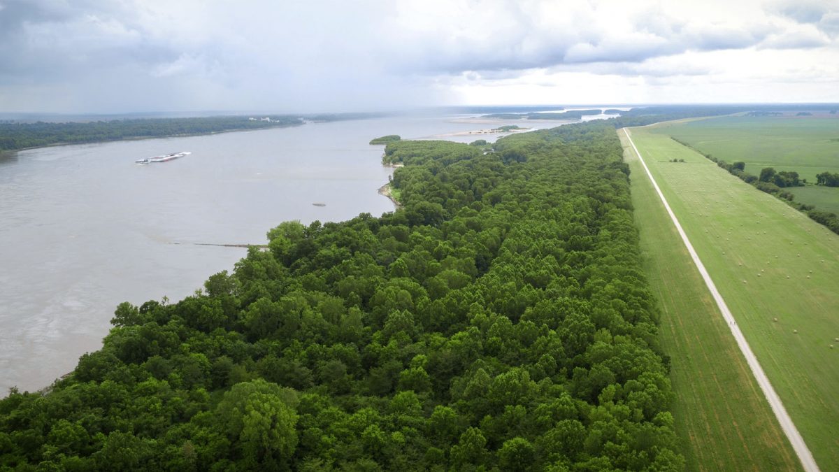
The coming high water expected for Memphis began as a wet pattern over Minnesota and Wisconsin in April and May, according to Anna Wolverton, a National Weather Service (NWS) meteorologist who also works for the Army Corps of Engineers Mississippi Valley Division. In June, an “extreme rainfall event” poured over southern Minnesota and South Dakota, she said, and “that’s what officially kicked this flood wave off and it’s still traveling down the Big River and that was three to four weeks ago now.”
As the mayors spoke during a press event, Thursday, the crest was moving though southern Iowa and into central Illinois and northern Missouri. The “really elongated crest“ lasted a few days at each river gauge, Wolverton said.


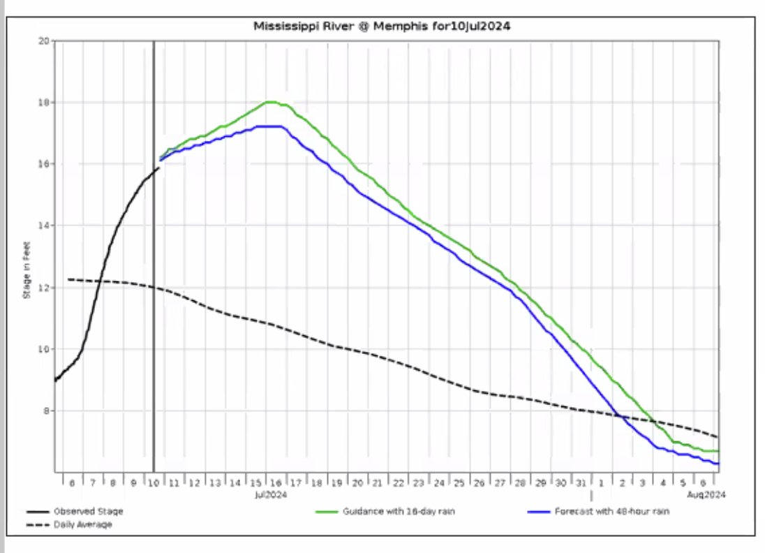
River levels at Memphis began to rise early this month, according to NWS data. On June 6th, the observed river stage was at nine feet. It continued to rise, reaching 16 feet on Thursday. Data from the United States Geological Survey’s (USGS) WaterWatch app said the river stage was at nearly 17 feet (well below the flood stage of 34 feet). The river is expected to crest at 18 feet Tuesday before falling again.

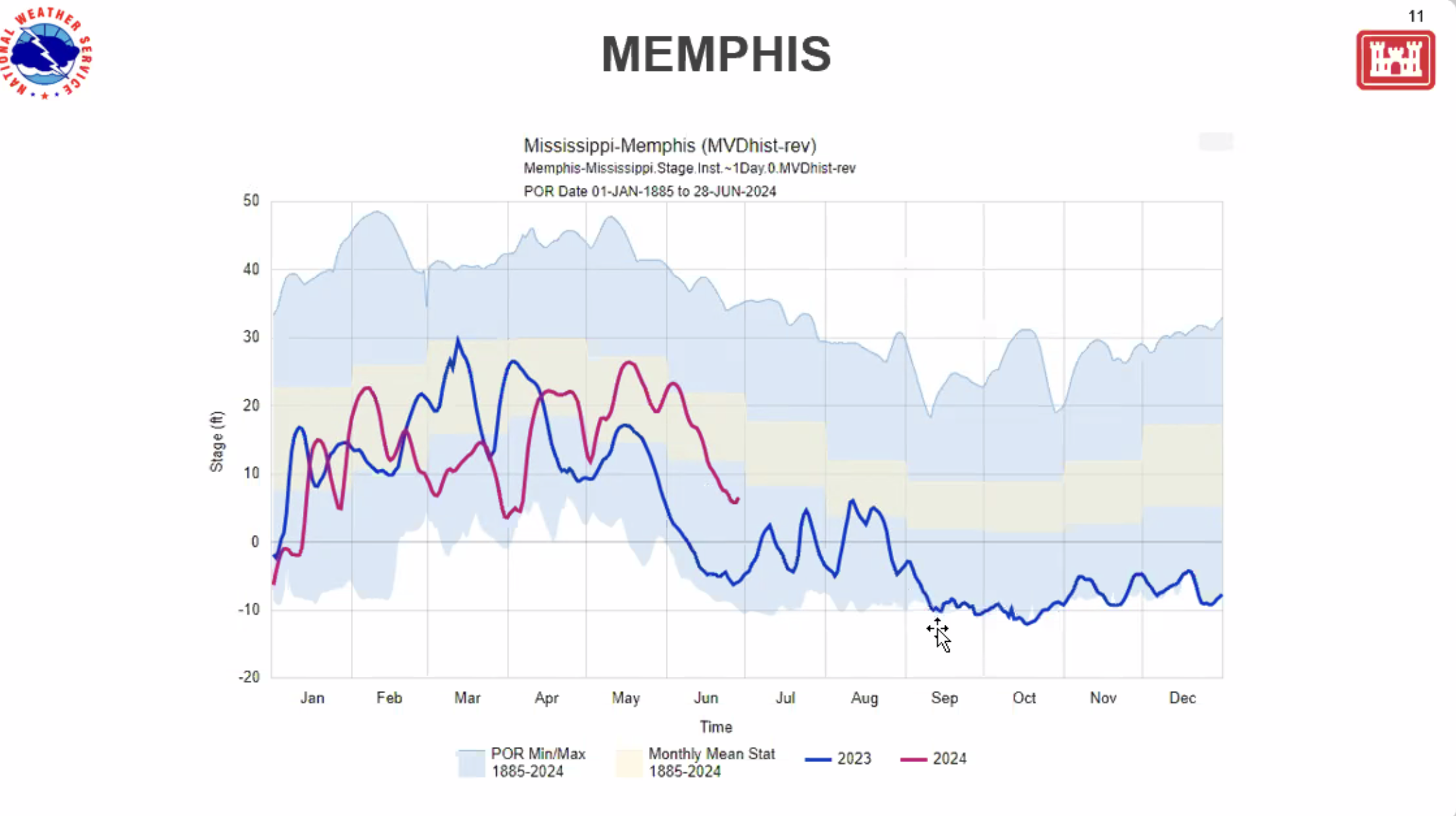
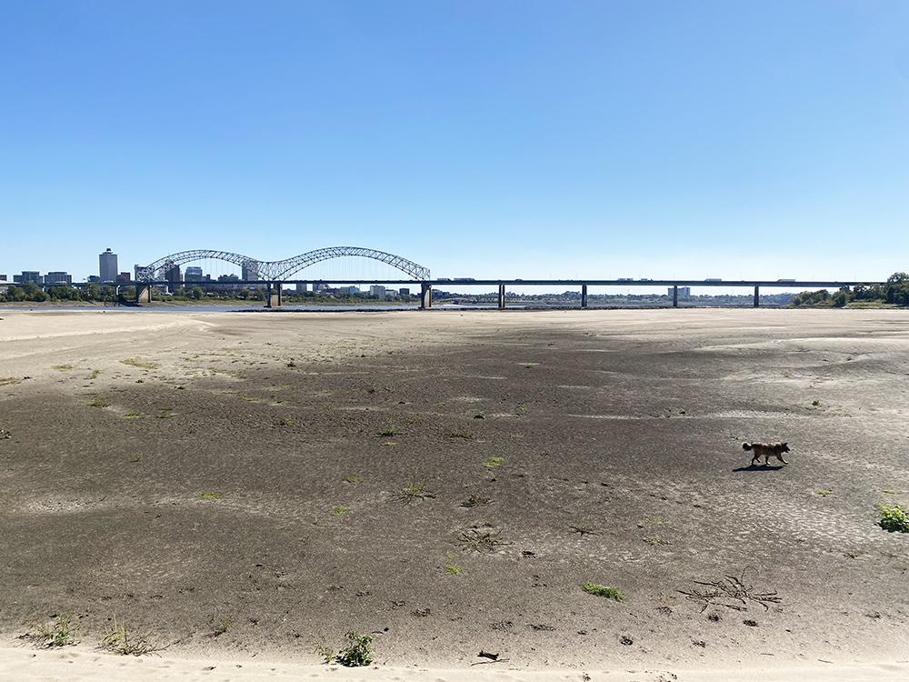
Anyone who remembers the bone-dry moonscapes of October 2022’s record-low river levels might wonder what else we can expect this year. Wolverton said it was nearly impossible to predict. But water levels had already begun to fall in early June last year, putting the river at least one month ahead of 2023.
“I expect at least another month or so before we’re talking about low water again,” Wolverton said.
“I expect at least another month or so before we’re talking about low water again.
Anna Wolverton, a National Weather Service (NWS) meteorologist who also works for the Army Corps of Engineers Mississippi Valley Division
But record-warm sea surface temperatures throughout The Atlantic Basin could draw more tropical storms. Federal agencies have already predicted a higher-than-normal hurricane season. Those could bring even more water to the Mississippi River.
So far, the Mississippi River system is prepared for excess water, according to Carl Winters, the USGS National Flood Coordinator. He said two big contributors for Mississippi River flows are waters from the Missouri River and the Ohio River.
While flows on the Missouri River are elevated (at about 90th percentile for historic flows), they are receding. However, flows from the Ohio are low, at about the 30th percentile for known flows. The flow for the Mississippi at Memphis was at 80 percent and rising last week, Winters said.
