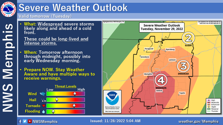
Severe weather is forecast for Memphis and the Mid-South Tuesday with tornadoes possible, according to the National Weather Service Memphis (NWSM).
The most severe weather is projected to arrive here tomorrow afternoon and could continue through Wednesday morning.
“Damaging winds and long-track tornadoes will be possible with highly organized storms,” said NWSM. ”Large hail and flash flooding are also possible, though they are secondary threats.”
On Sunday, the threat raised the area to an Enhanced Risk (orange level, level three of five) for severe storms. On Monday, Memphis was raised to a Moderate Risk (four out of five).
“Moderate Risks are used sparingly and should not be taken lightly,” MNSW said in a tweet. “Take the time to plan and prepare now.”
In a tweet Sunday, NWSM said “damaging winds, tornadoes, flooding, and large hail are on the table” for Tuesday. “Long-track tornadoes will be possible, and some could be significant,” said the agency.
Read this tweet thread for detailed information about the storm from MNSW:
NWSM continued to raise the alarm about the threat on Monday.
The Memphis Office of Emergency Management tweeted these tips to get ready:
Memphis Light, Gas & Water (MLGW) said it is readying crews to “work around the clock” to respond to power outages the storm may cause.