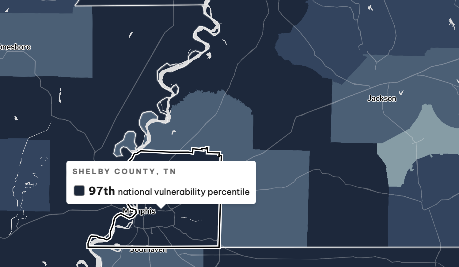
In the U.S., Shelby County is one of the areas most vulnerable to climate change.
That’s according to the new U.S. Climate Vulnerability Index, developed in partnership between the Environmental Defense Fund and Texas A&M University. The study shows, basically, which areas of the country will suffer the most as climate change continues, and continues to get worse.
Climate change vulnerability is more than just susceptibility to environmental disasters like droughts, wildfires, and floods. The new tool considered 184 sets of public data to establish how communities may suffer under climate change.
“Climate change will cause a range of related risks, including increases in infectious and chronic disease, intensified social and economic stresses, and more frequent extreme weather events,” reads the tool’s website. “Vulnerable groups will be disproportionately affected due to greater exposure to climate risks and lower ability to prepare, adapt, and recover from their effects.”

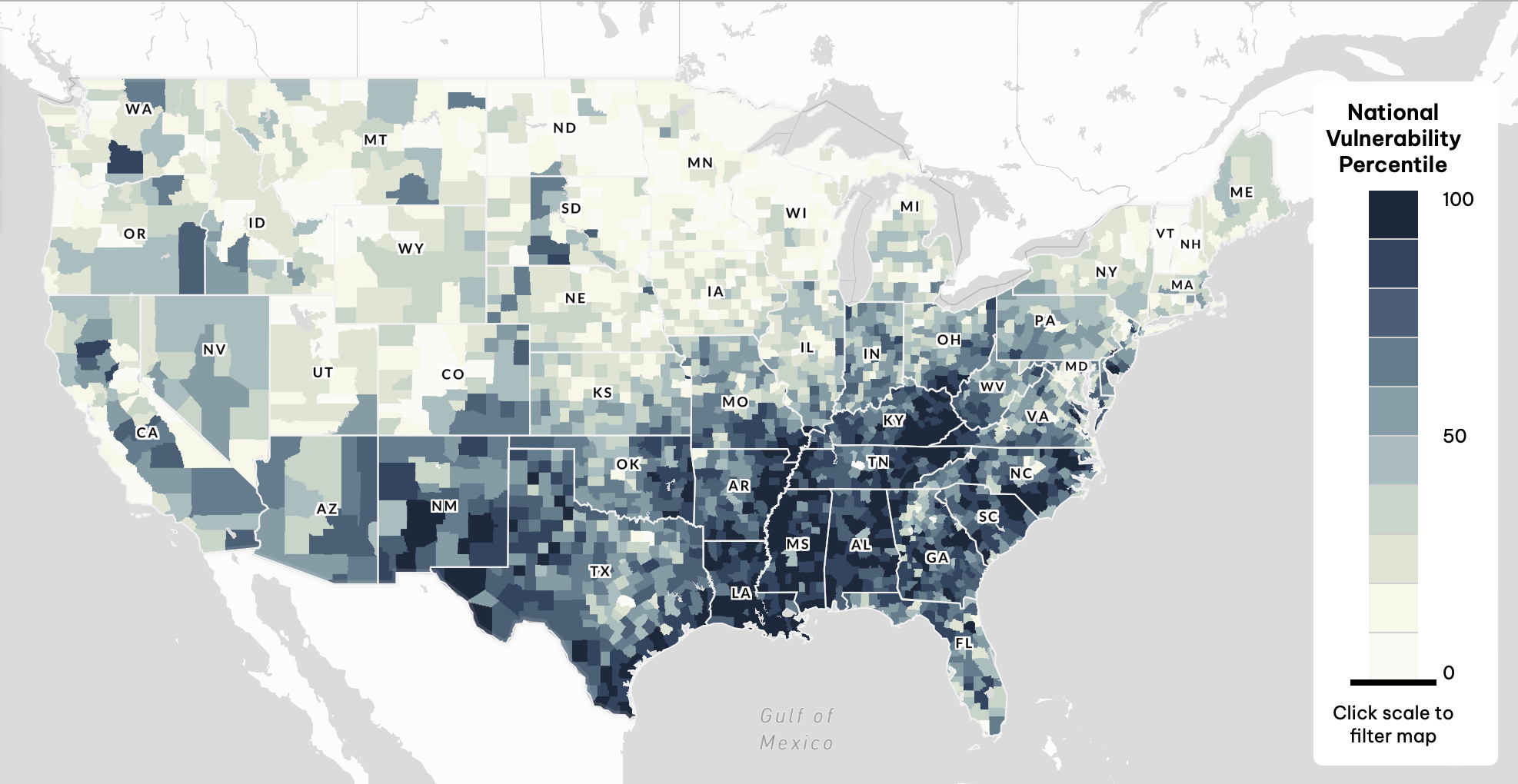
The U.S. Southeast is particularly vulnerable to climate change, according to the study. Areas in the Northeast, Midwest, and West were scored among the least vulnerable in the country.
Shelby County scored in the 97th percentile of vulnerable counties in the nation. The score put the Memphis area only slightly behind Louisiana’s Cancer Alley for climate vulnerability.

Shelby’s score did not, however, rank it among the country’s top-10 most vulnerable counties. Five of the top 10 counties ranked worse in the study were in Louisiana. Three were in Kentucky. Sites in Texas and South Carolina rounded out the top 10.
Shelby County did not even rank first for potential climate suffering in Tennessee. It ranked 9th behind counties mostly in East Tennessee.
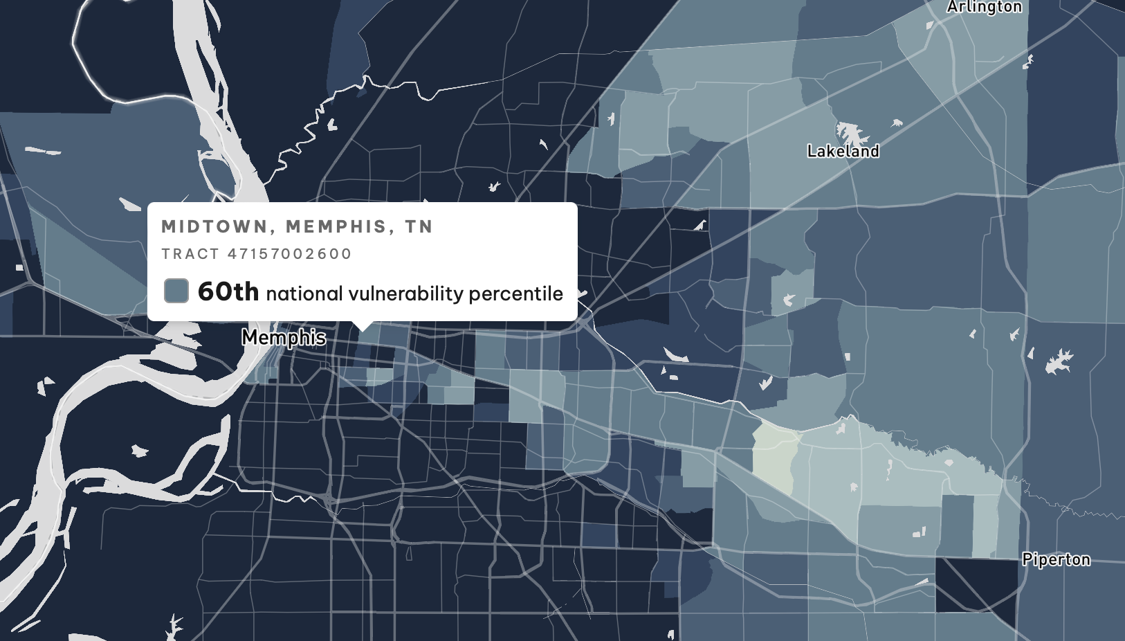
Shelby County did earn the top spot in one national metric, however. Shelby had the most census tracts (21) concentrated in one county among the top 100 most vulnerable.
These at-risk communities are in lower-income areas north of Downtown, like Frayser, Alta Vista, Douglass, and Hollywood. They can also be found in areas of the county south of Downtown like Riverview, Walker Homes, Valley Forge, and Whitehaven.
Areas inside the I-240 Loop deemed to suffer less during climate change are inside the Downtown business and entertainment districts, and those along the Poplar Corridor. Most areas east of and outside of the Loop are less vulnerable to climate change, the report said.

Areas less at risk of climate change vulnerability here are predominately more wealthy. One outlier, however, is a section of Collierville, which is seemingly more at risk thanks to the presence of a Carrier Air Conditioning Co. Superfund site.
Shelby County scored high (which is bad) for exposures to harmful materials. Overall, the county scored in the 98th percentile of all U.S. counties for the total amount of toxic chemicals released into an area.
Toxins released in the air are particular threats in Shelby County. The county scored in the 98th percentile for the amount of air pollution regulated by the government. The county scored near the top in categories showing how dangerous those toxic air pollutants and diesel particles are to the body’s nervous system (99th percentile), thyroid (99th percentile), and in increased cancer risk (94th percentile).
The county also scored high for the amount of land that is developed here, the number of payday lenders, affordable housing, traffic congestion, the total number of road miles per person, road quality, indoor plumbing, the cost of climate disasters, residential energy expenditures, and more.
