January
2021 was twice as deadly as 2020 for Covid-19 in Shelby County. In 2020, 903 died of Covid here. In 2021, 1,807 passed from the virus.
A consent decree forced Horn Lake leaders to approve the construction of a new mosque.
Family members wanted $20 million from the city of Memphis; Memphis Light, Gas and Water (MLGW); and the Memphis Police Department (MPD) for the 2020 beating death of a man by an MLGW employee.
New DNA testing was requested in the West Memphis Three case for recently rediscovered evidence once claimed to be lost or burned.
February
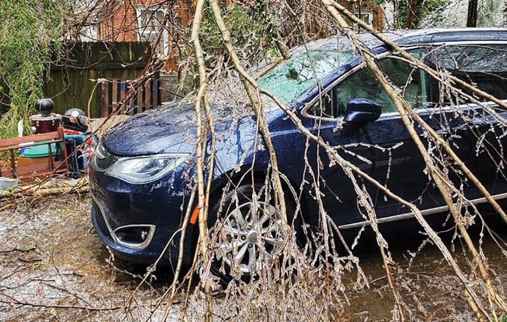
An ice storm knocked out power to nearly 140,000 MLGW customers.
The new concourse — in the works since 2014 — opened at Memphis International Airport.
Paving on Peabody Avenue began after the project was approved in 2018.
Protect Our Aquifer teamed up with NASA for aquifer research.
A prosecutor moved to block DNA testing in the West Memphis Three case.
March
A bill before the Tennessee General Assembly would have banned the sale of hemp-derived products, like Delta-8 gummies, in the state. It ultimately provided regulation for the industry.
The project to fix the interchange at Crump Ave. and I-55 resurfaced. Bids on the project, which could cost up to $184.9 million, were returned. Work did not begin in 2022 but when it does, it could close the Memphis-Arkansas Bridge (the Old Bridge) for two weeks.
Tennessee Governor Bill Lee temporarily cut sales taxes on groceries.
April
The Mississippi River ranked as one of the most endangered rivers in America in a report from the American Rivers group.
Critics lambasted decisions by Memphis in May and Africa in April to honor Ghana and Malawi, both of which outlaw basic LGBTQ+ rights.
The federal government announced a plan to possibly ban menthol cigarettes.
Lawmakers approved Gov. Lee’s plan to update the state’s 30-year-old education funding plan.

May
Planned Parenthood of Tennessee and North Mississippi prepared for the likely overturn of the Roe v. Wade decision, ending legal abortions in the state.
The Greater Memphis Chamber pressed for a third bridge to be built here over the Mississippi River.
Cooper-Young landlords sued to evict the owners of Heaux House for “specializing in pornographic images.”
The Memphis City Council wanted another review of Tennessee Valley Authority’s (TVA) plan to remove coal ash from the shuttered Allen Fossil Plant.
June
New research showed Memphis-area women earned 83 percent of their male counterparts income in the workplace from 2000-2019.
Gov. Lee ordered schools to double down on existing security measures in the wake of the mass shooting at an elementary school in Uvalde, Texas.
MPD arrested four drivers in an operation it called Infiniti War Car Take-Over.
A key piece of the Tom Lee Park renovation project won a $3.7 million federal grant, which was expected to trigger nearly $9 million in additional funds.
Tennessee Republican attorney general fought to keep gender identity discrimination in government food programs.
Jim Dean stepped down as president and CEO of the Memphis Zoo and was replaced by Matt Thompson, then the zoo’s executive director and vice president.
Locals reacted to the U.S. Supreme Court’s decision to overturn Roe v. Wade.
July
Memphian Brett Healey took the stage at Nathan’s Famous Fourth of July Eating Contest.
One Beale developers returned to Memphis City Hall for the fourth time asking for financial support of its luxury hotel plans.
The Memphis-Shelby County Schools (MSCS) board placed Superintendent Joris Ray on paid leave as they investigated whether he violated district policies with relationships with co-workers and abused his power.
The project to forever eliminate parking on the Overton Park Greensward got $3 million in federal funding.
Tennessee’s attorney general celebrated a win after a federal judge blocked a move that would have allowed trans kids to play sports on a team of their gender.
Tennessee’s top Pornhub search was “interracial” in 2021, according to the site.
August
A panel of Tennessee judges did not give a new trial to Barry Jamal Martin, a Black man convicted in a Pulaski jury room decked out in Confederate portraits, flags, and memorabilia.
Shelby County Clerk Wanda Halbert caught flak from the Tennessee Comptroller after traveling to Jamaica while her offices were closed to catch up on the controversial backlog of license plate requests from citizens.
MSCS superintendent Joris Ray resigned with a severance package worth about $480,000. Finance chief Toni Williams was named interim superintendent.
Officials said the Memphis tourism sector had made a “full recovery” from the pandemic.
A new bail system unveiled here was touted by advocates to be “one of the fairest in the nation.”

September
Memphis kindergarten teacher Eliza Fletcher was abducted and murdered while on an early-morning run. Cleotha Abston, out of jail early on previous abduction charges, was arrested for the crimes.
MLGW’s board continues to mull the years-long decision to, possibly, find a new power provider.
Ezekiel Kelly, 19, was arrested on charges stemming from an alleged, hours-long shooting rampage across Memphis that ended with four dead and three injured.
A Drag March was planned for the “horrible mishandling” of a drag event at MoSH. Event organizers canceled the show there after a group of Proud Boys arrived armed to protest the event.
October
Workers at four Memphis restaurants, including Earnestine & Hazel’s, sued the owners to recover alleged unpaid minimum wage and overtime.
Shelby County was largely unfazed by an outbreak of monkeypox with only about 70 infected here as of October.
Animal welfare advocates called a University of Memphis research lab “the worst in America” after a site visit revealed it violated numerous federal protocols concerning the care of test animals.
While other states have outlawed the practice, Tennessee allows medical professionals and medical students to — without any kind of permission — stick their fingers and instruments inside a woman’s vagina and rectum while she is under anesthesia.
Joshua Smith, a co-defendant in the election finance case against former state Sen. Brian Kelsey, pleaded guilty in court.
The Environmental Protection Agency told South Memphis residents little could be done to protect them from toxic emissions from the nearby Sterilization Services facility.
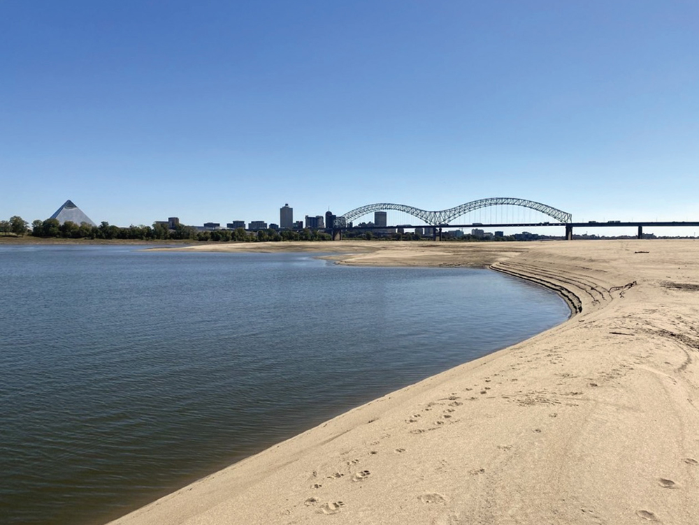
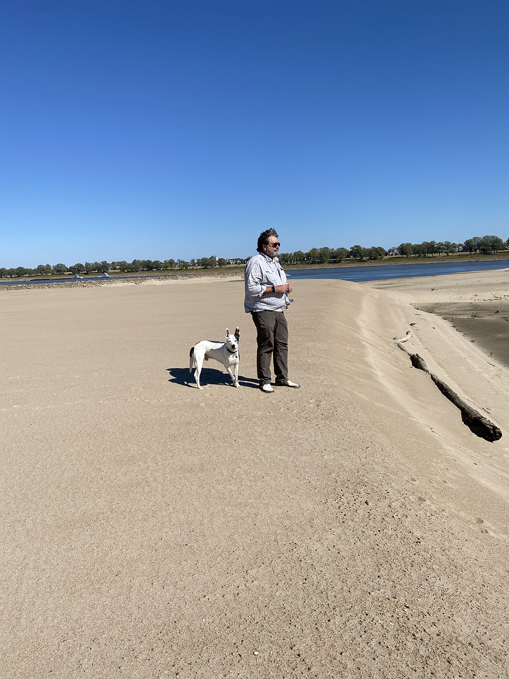
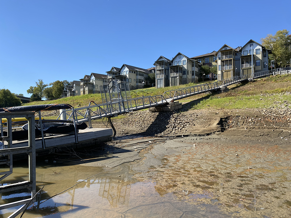
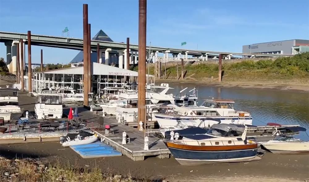
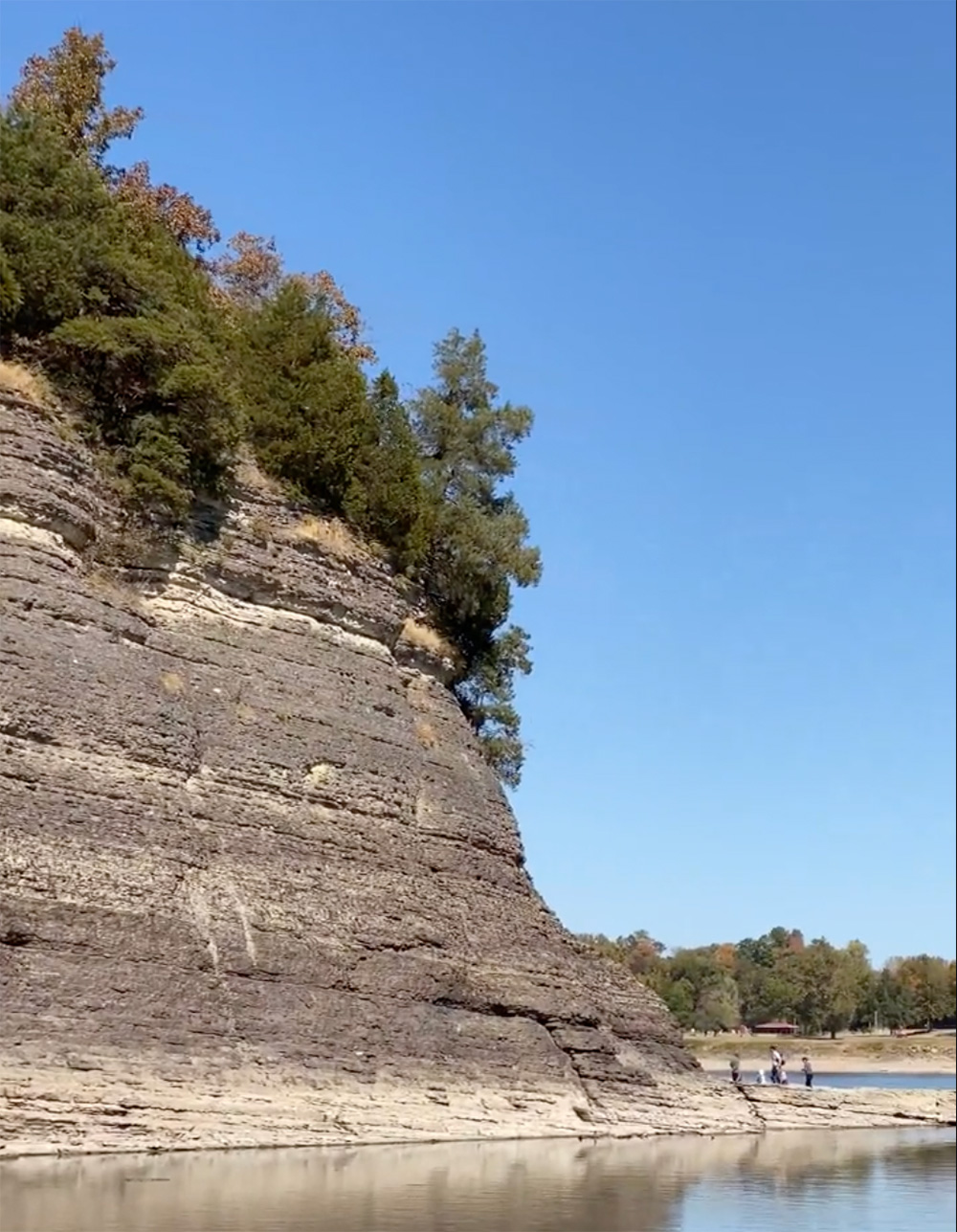
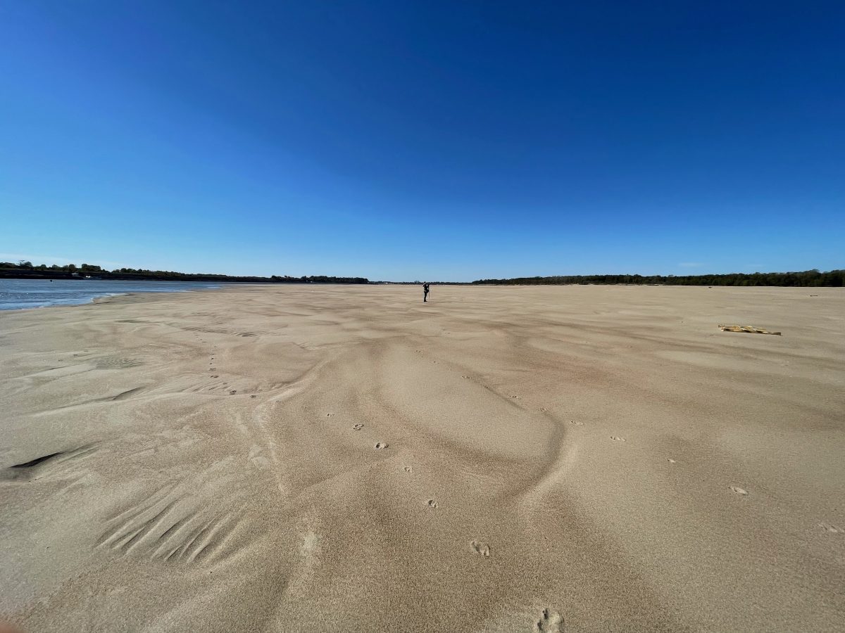
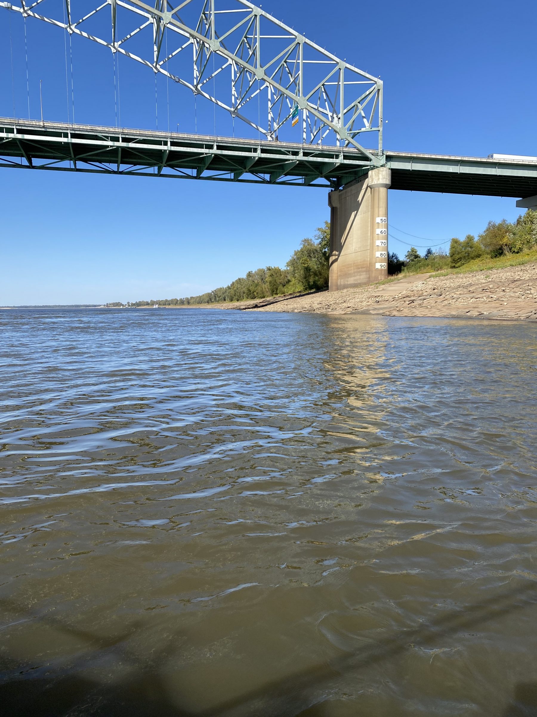
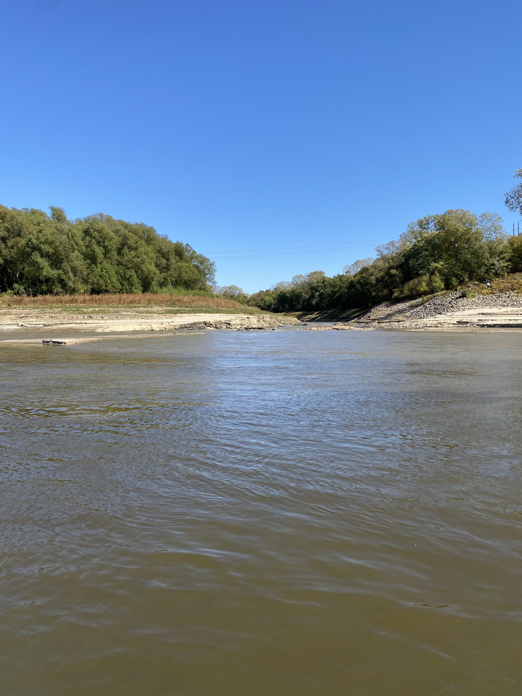
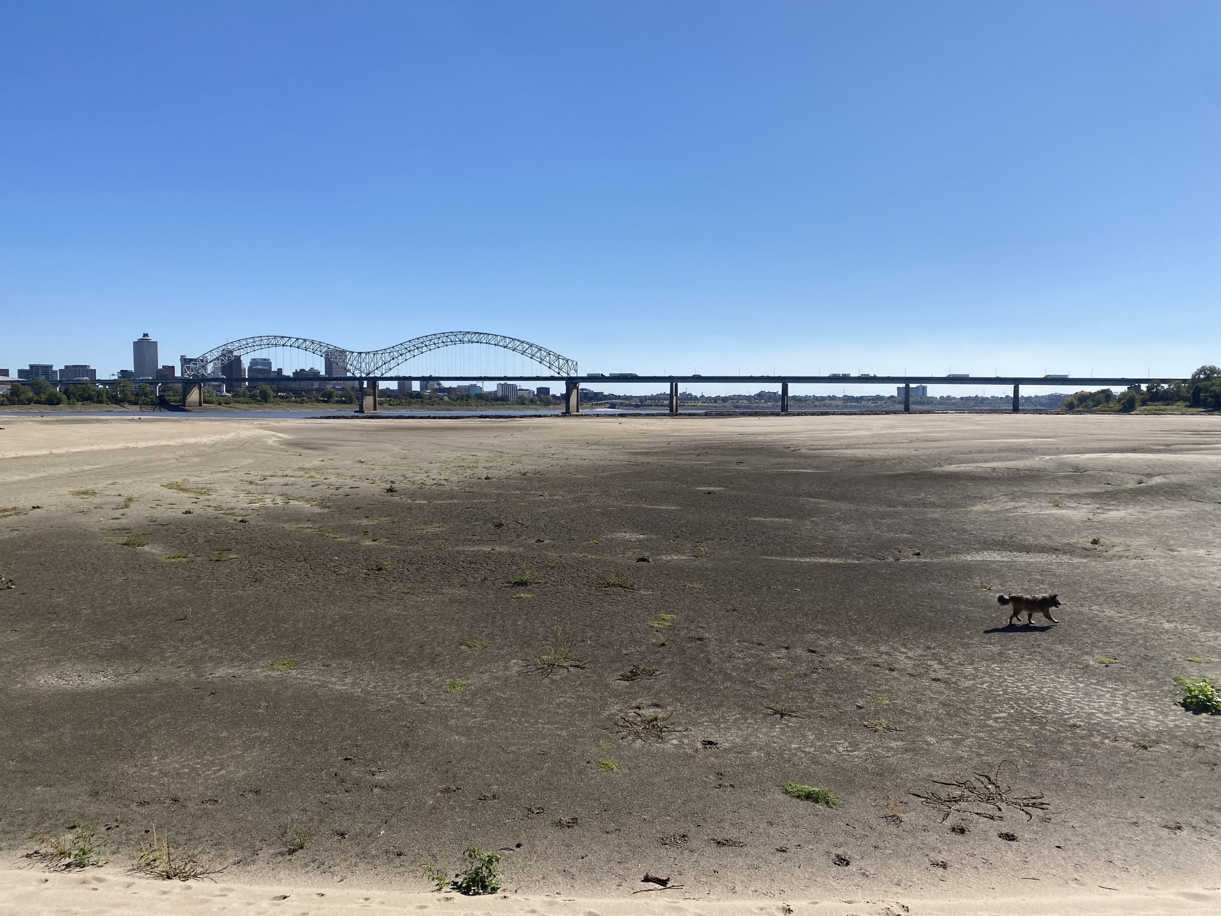
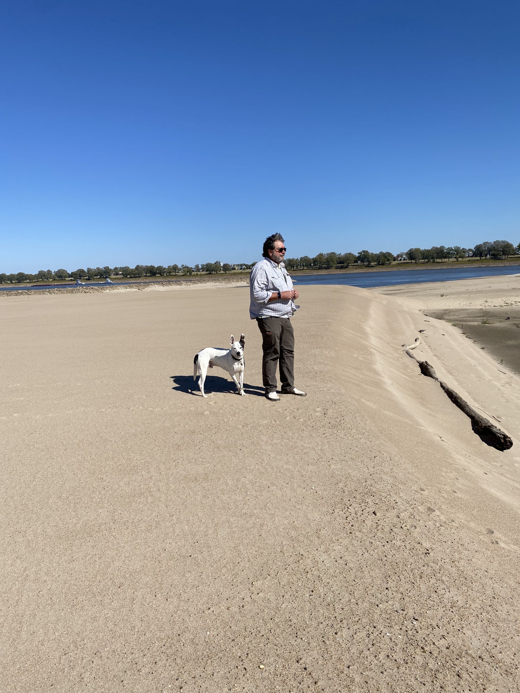
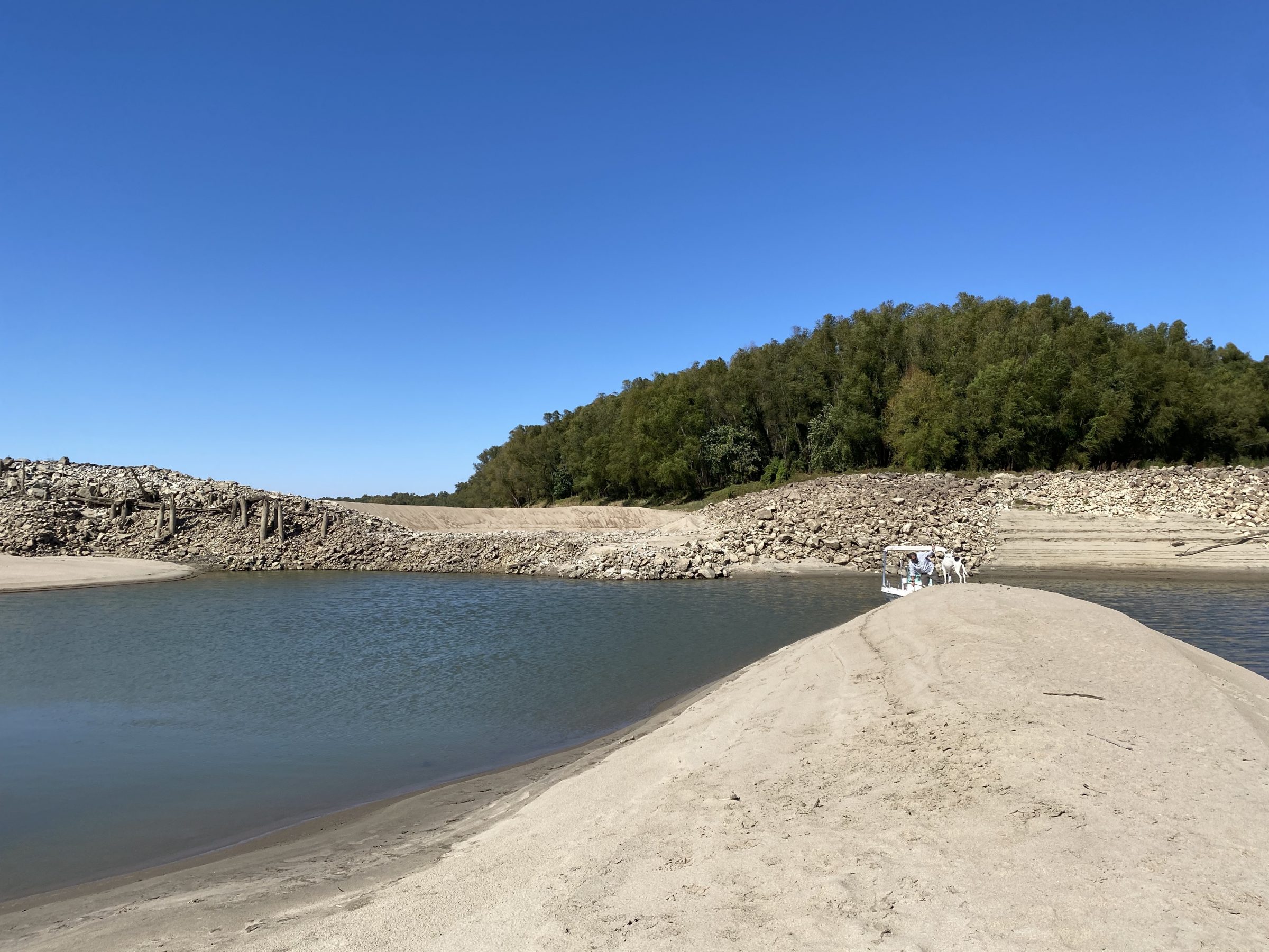
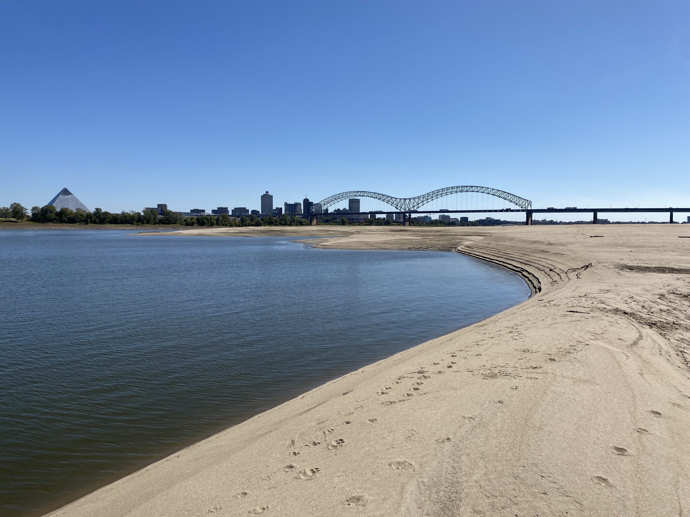
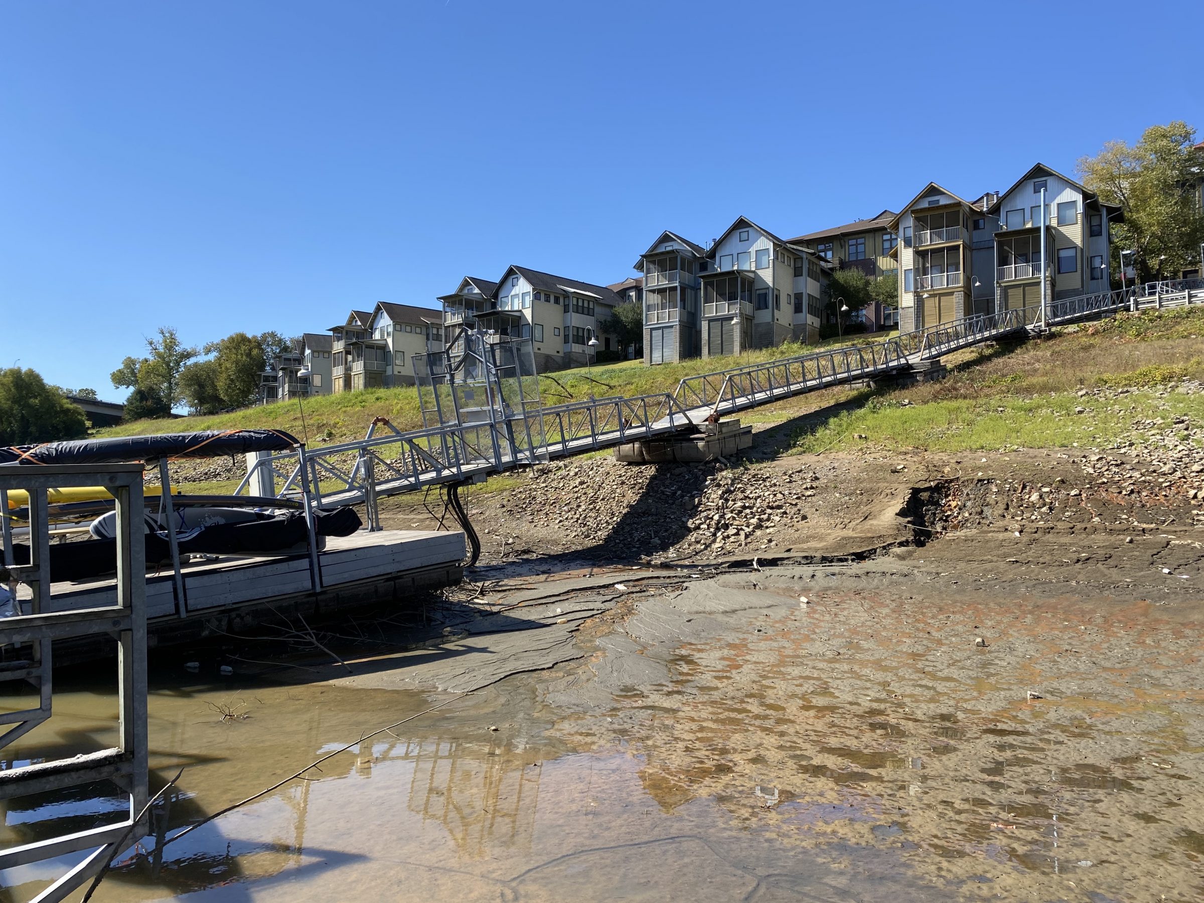
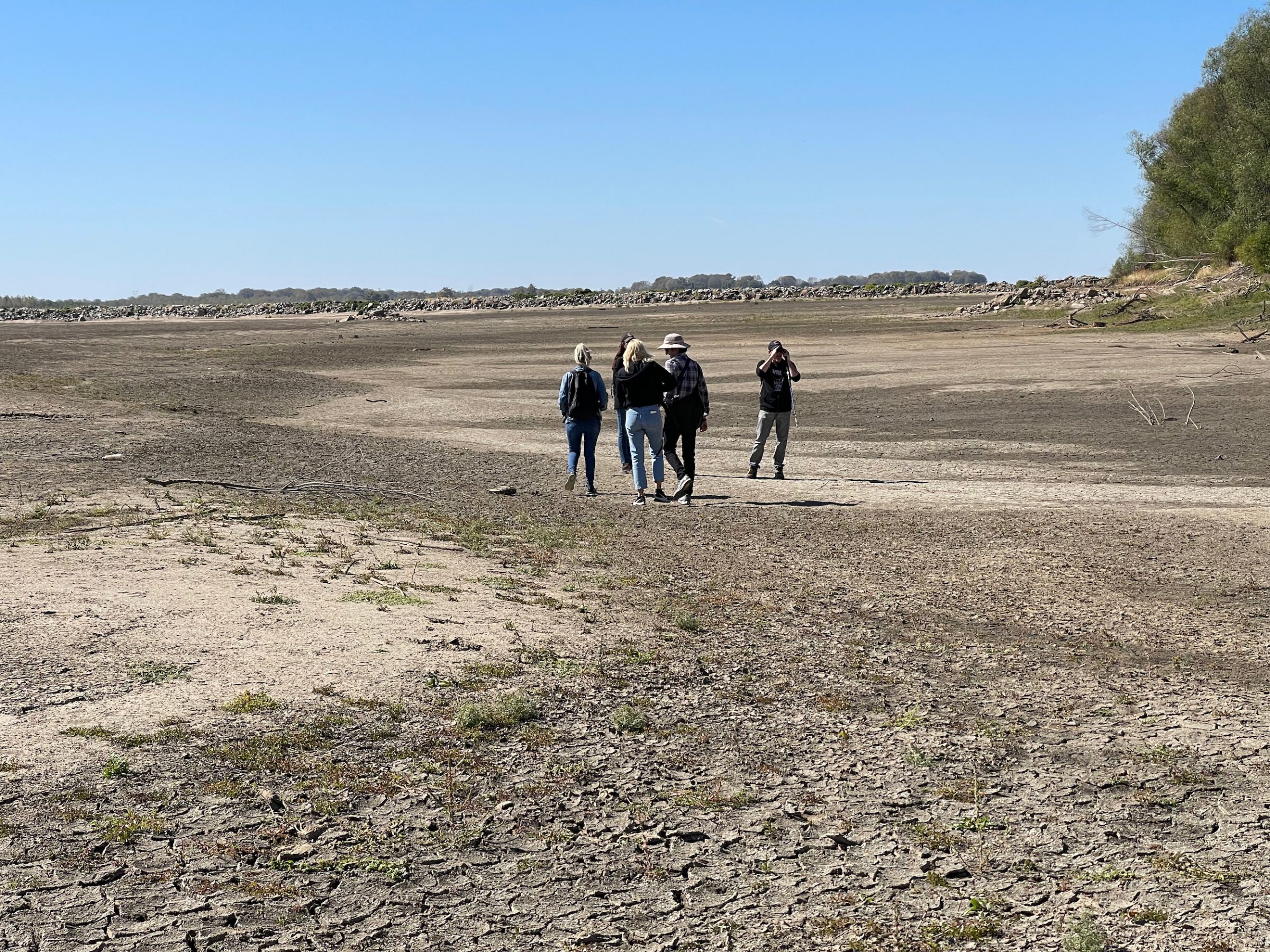
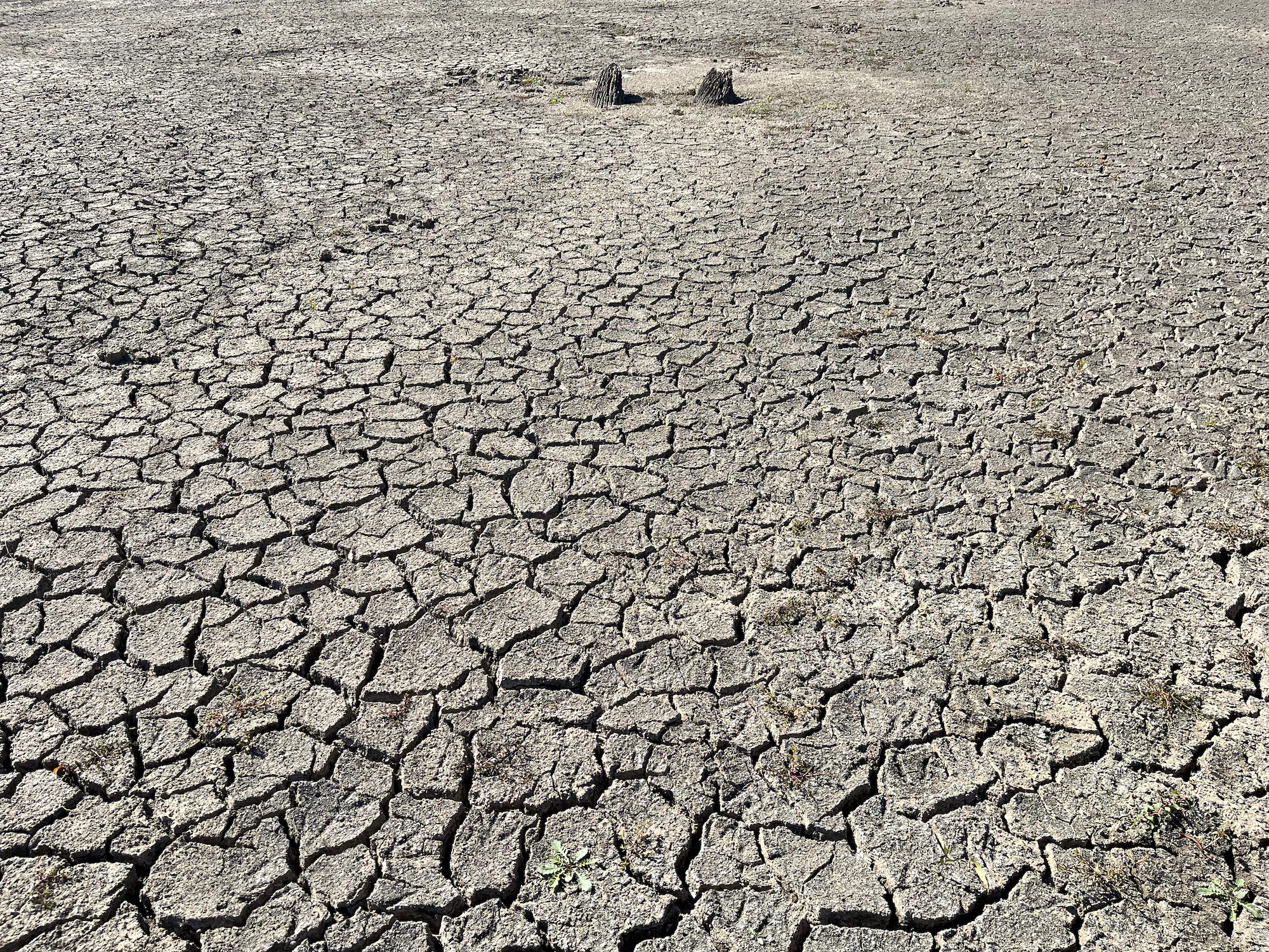
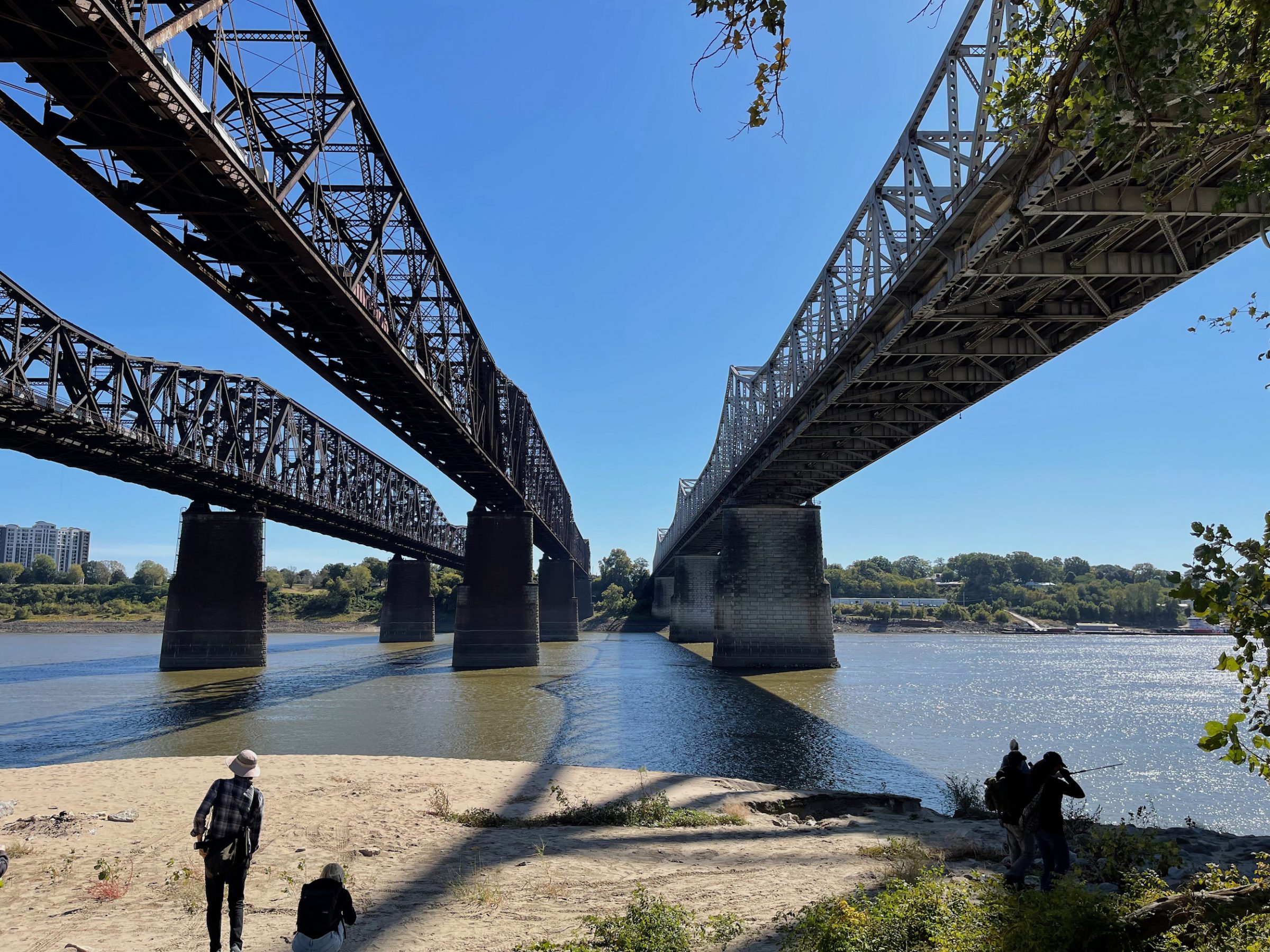
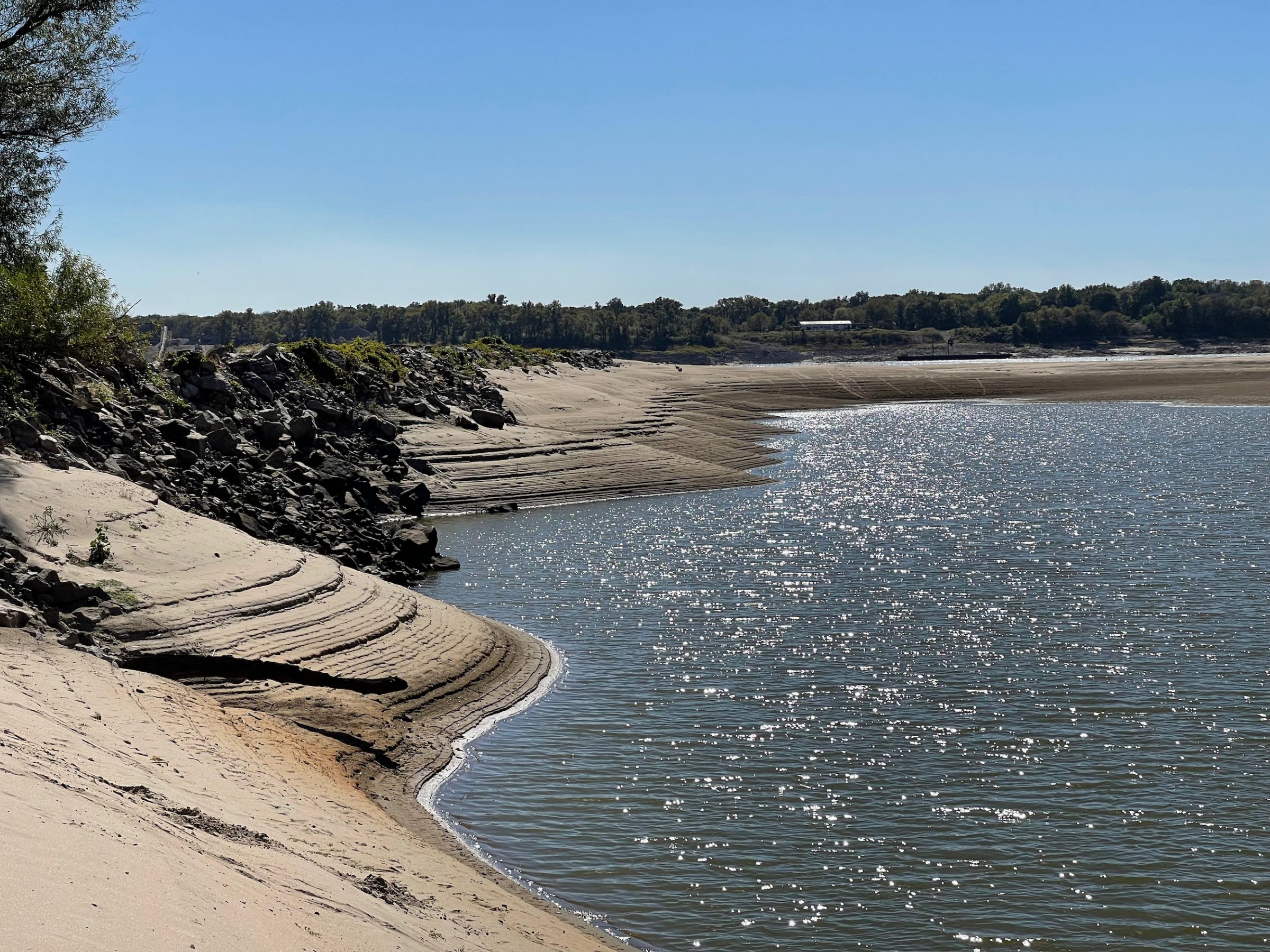
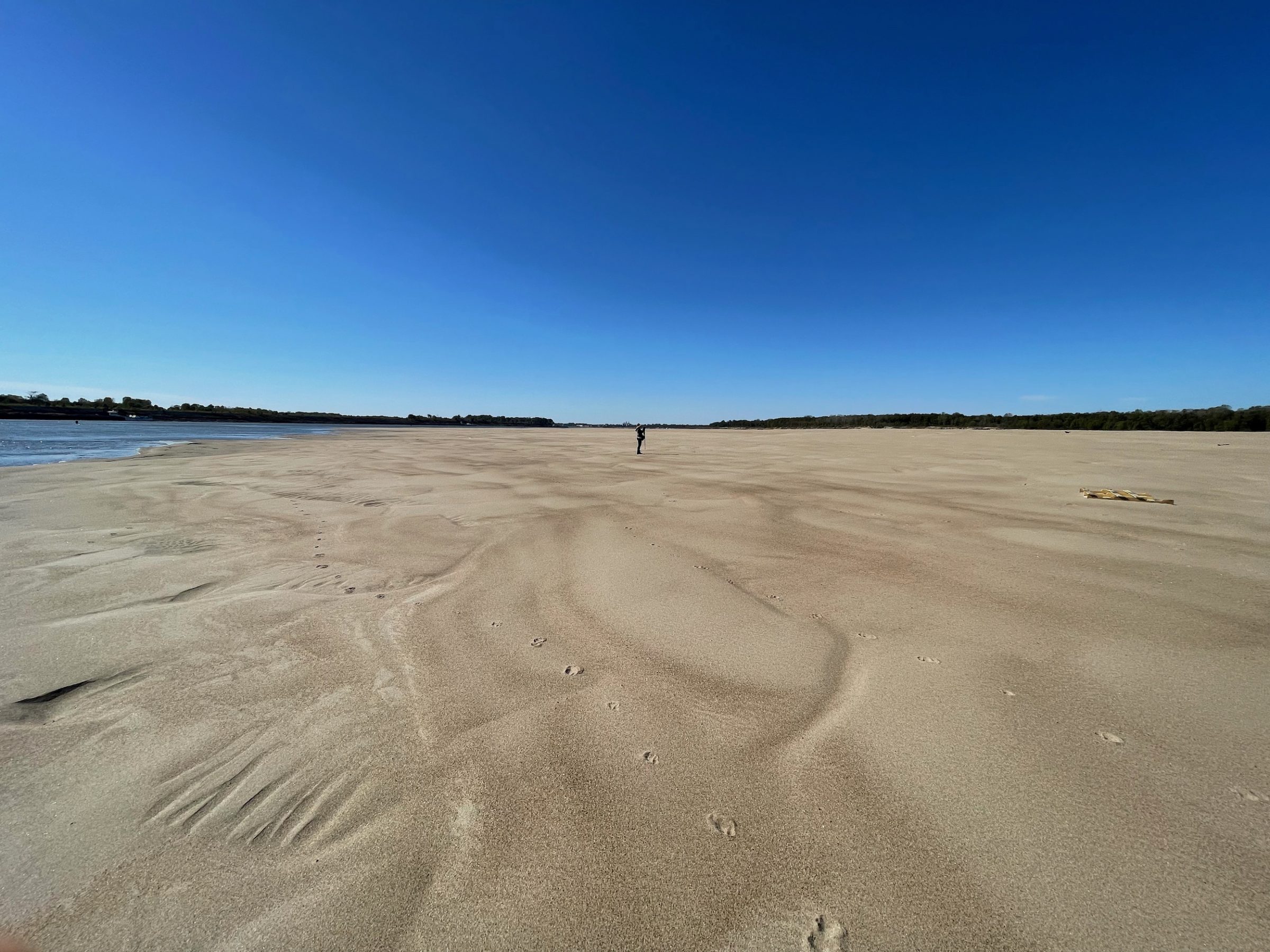
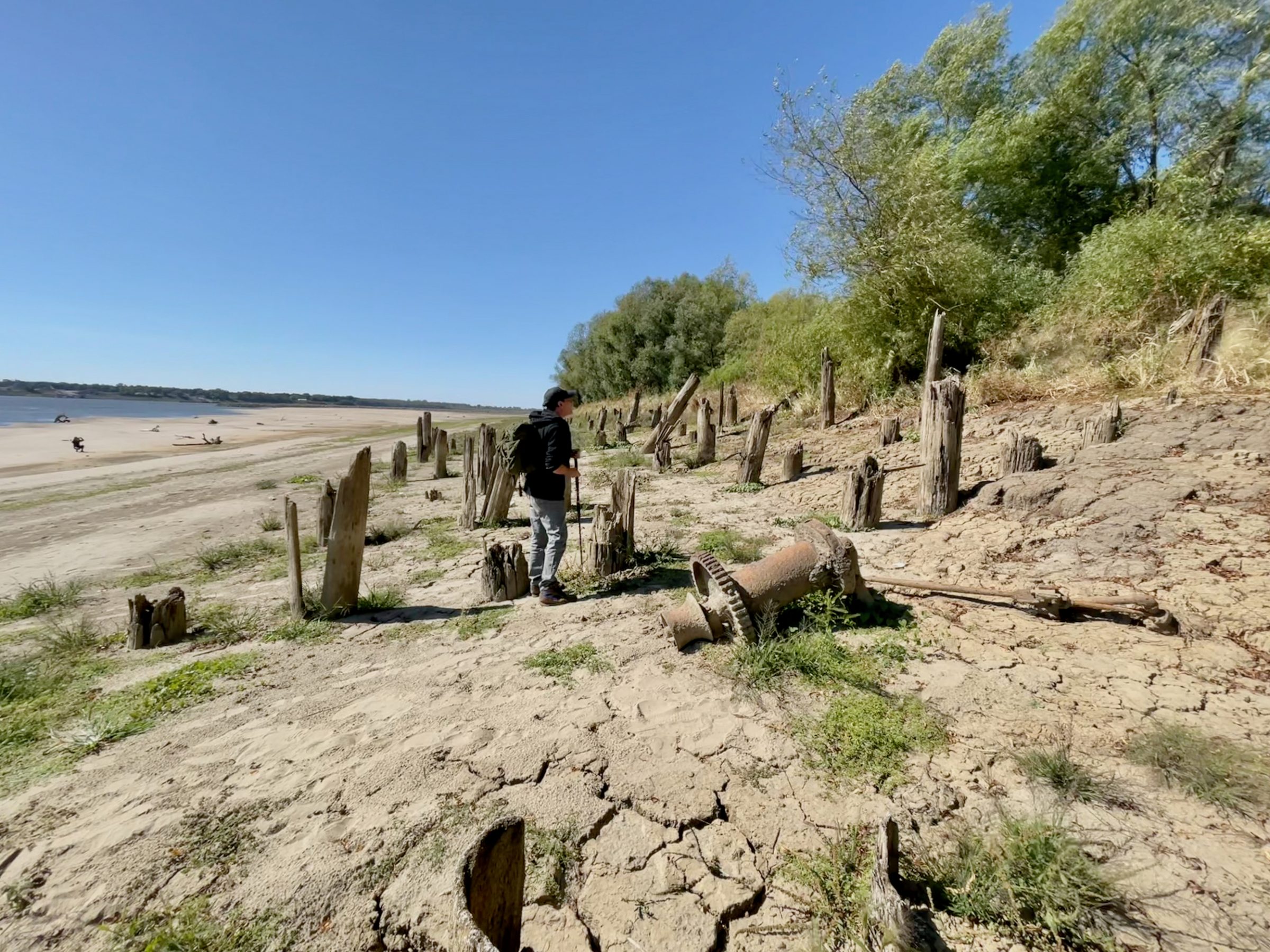
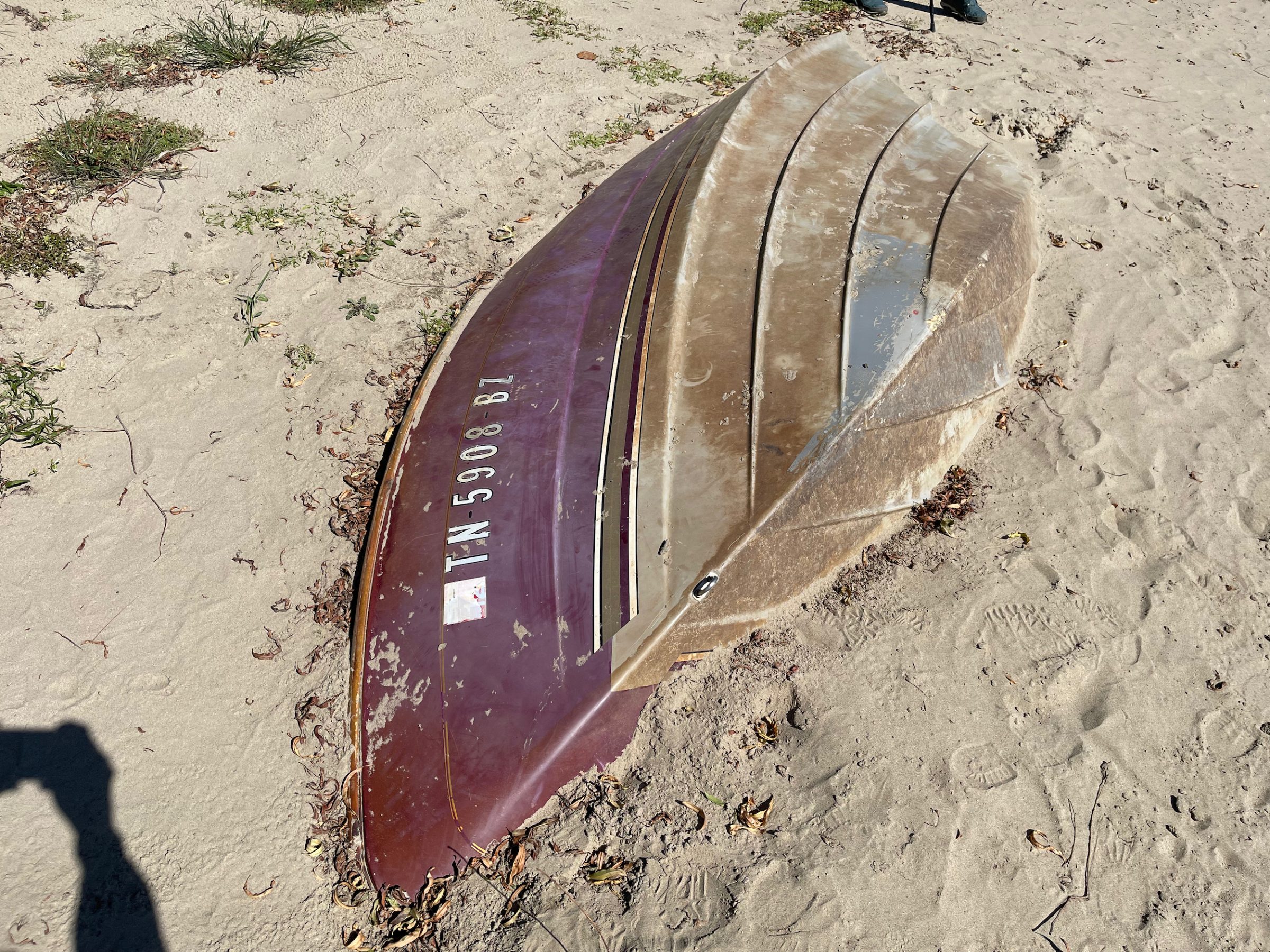
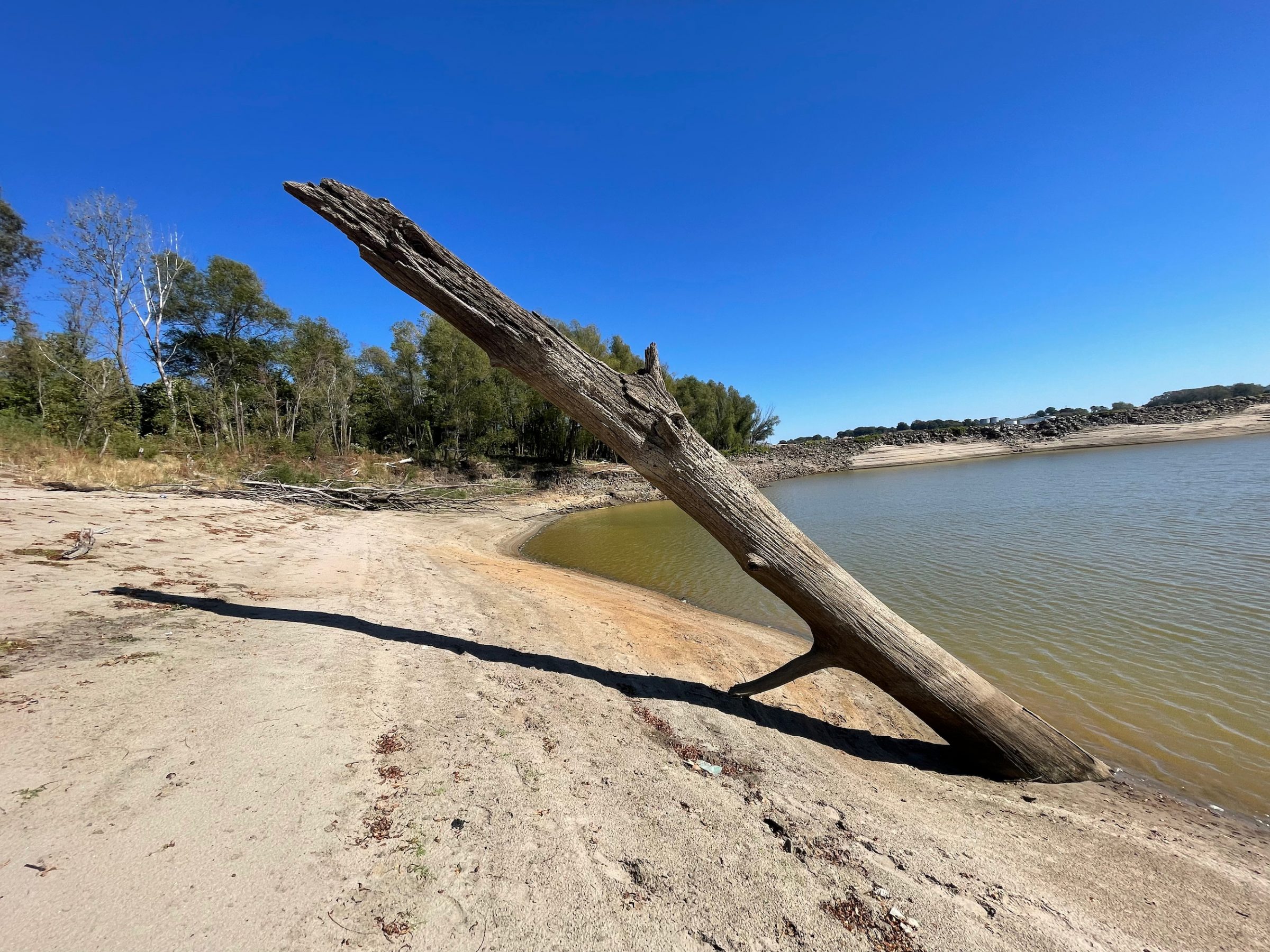
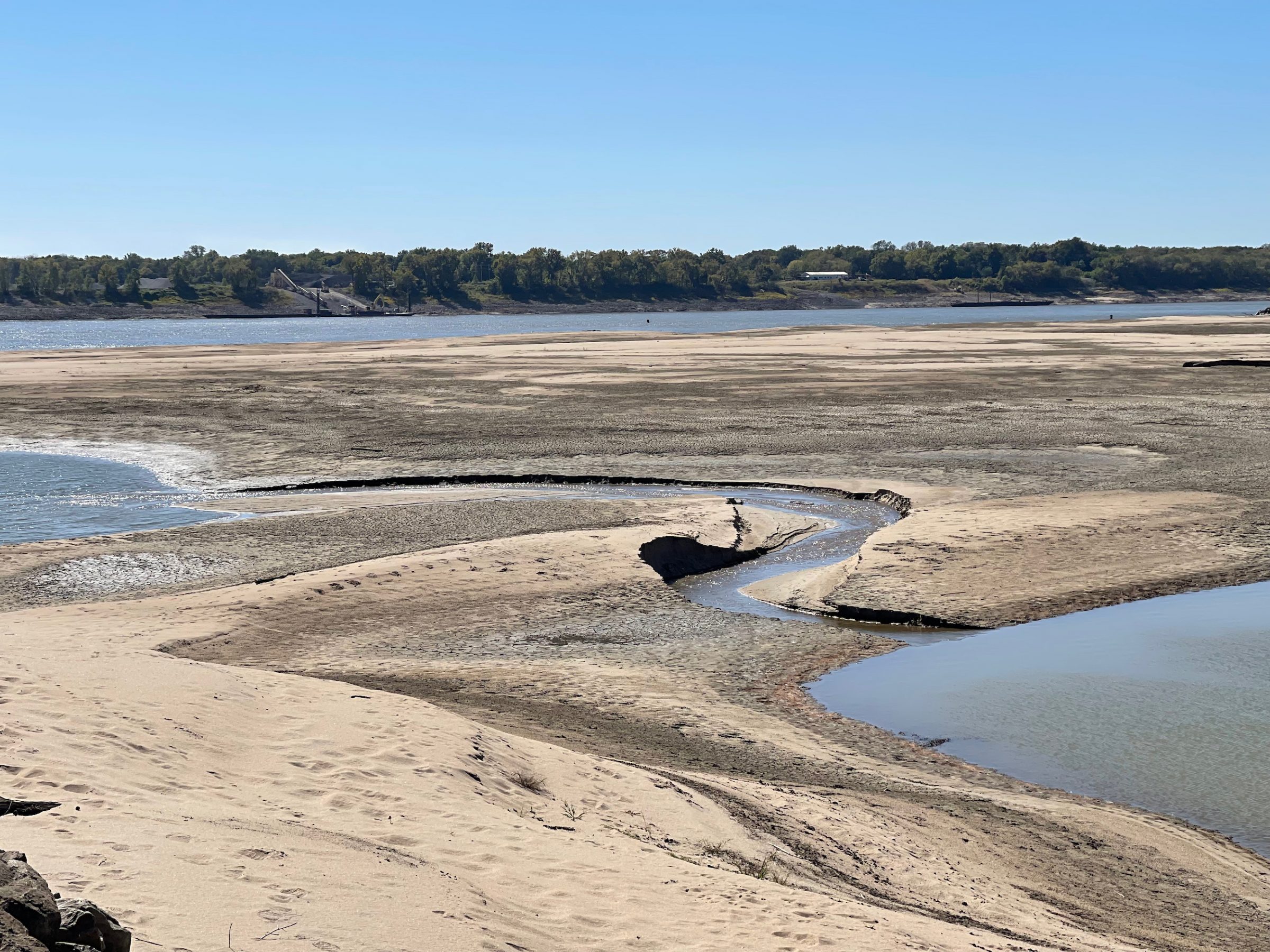
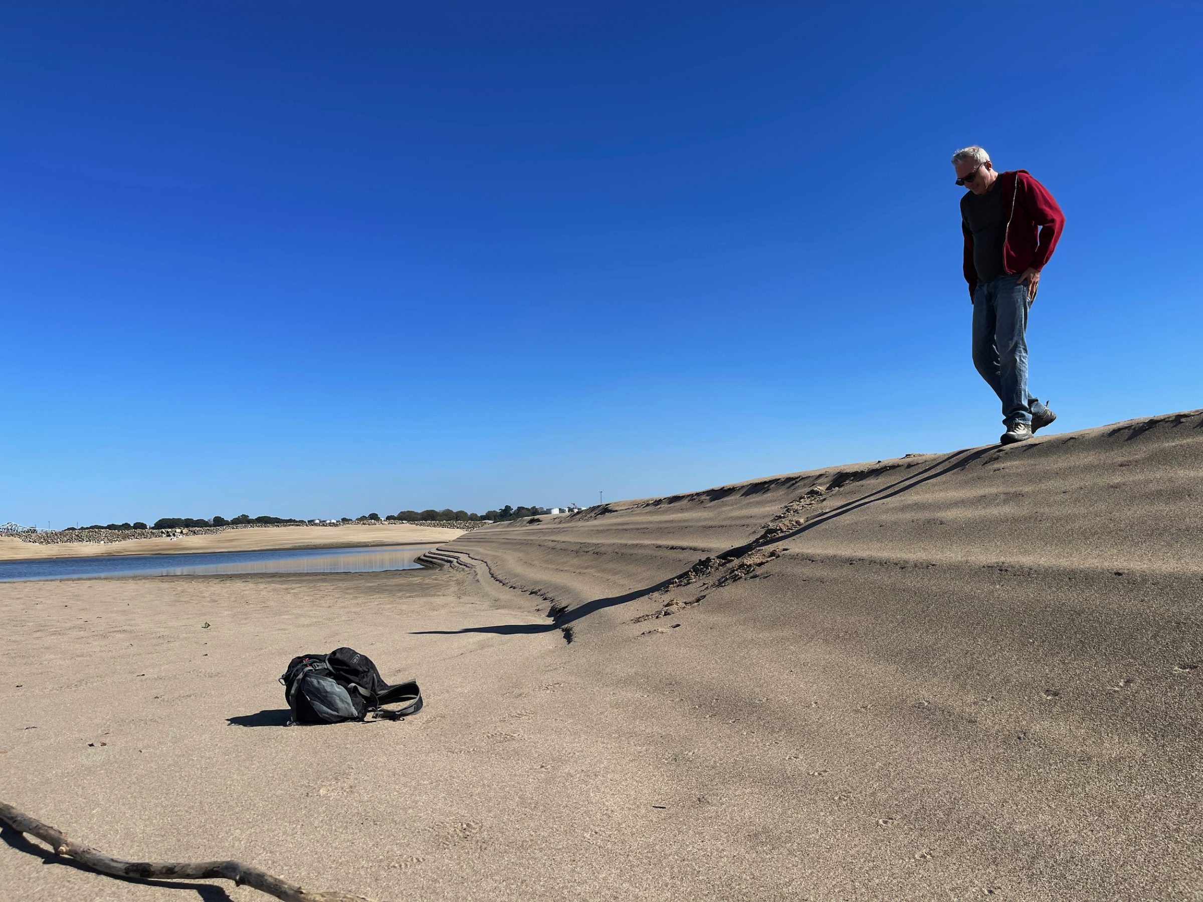
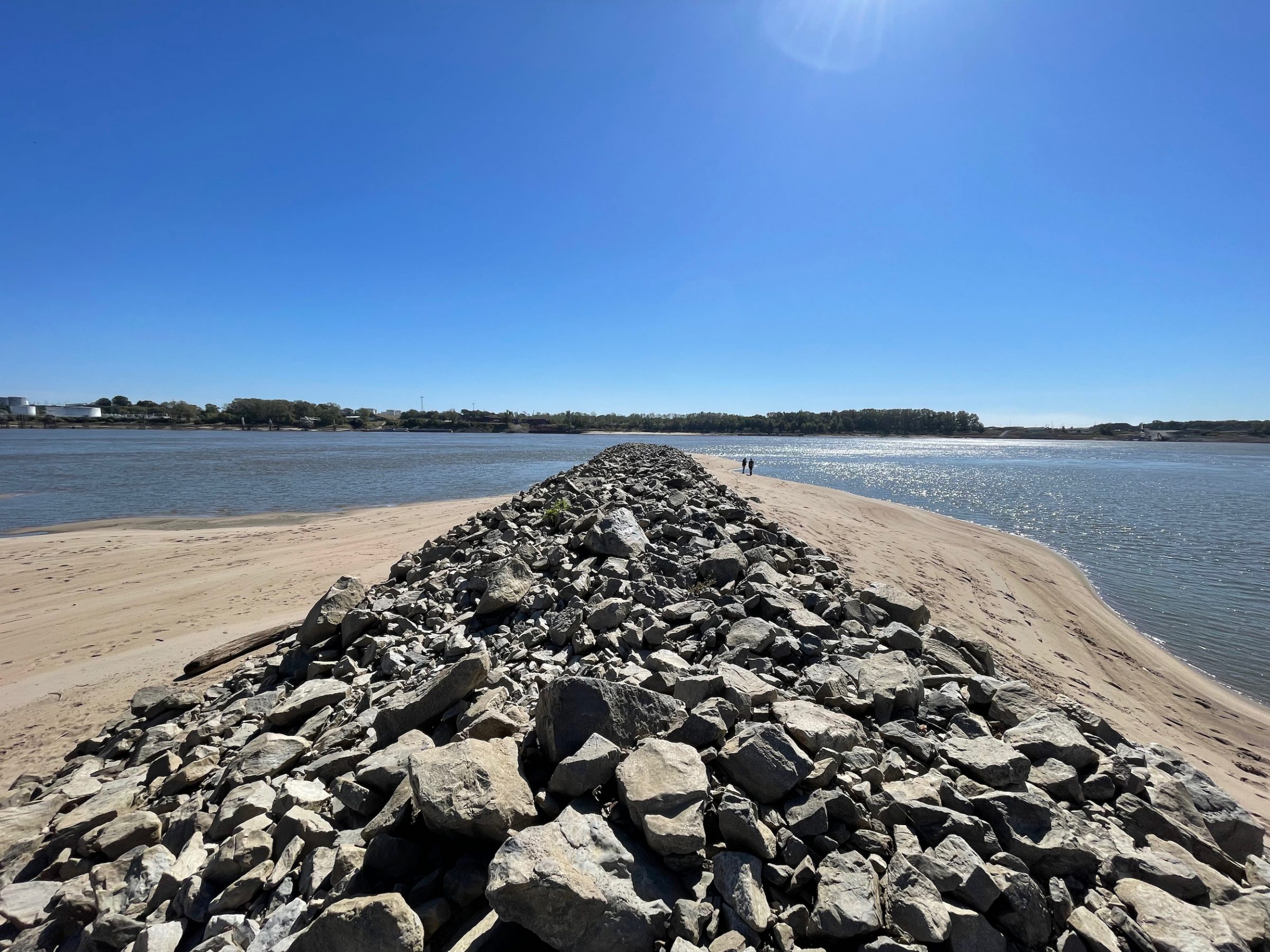
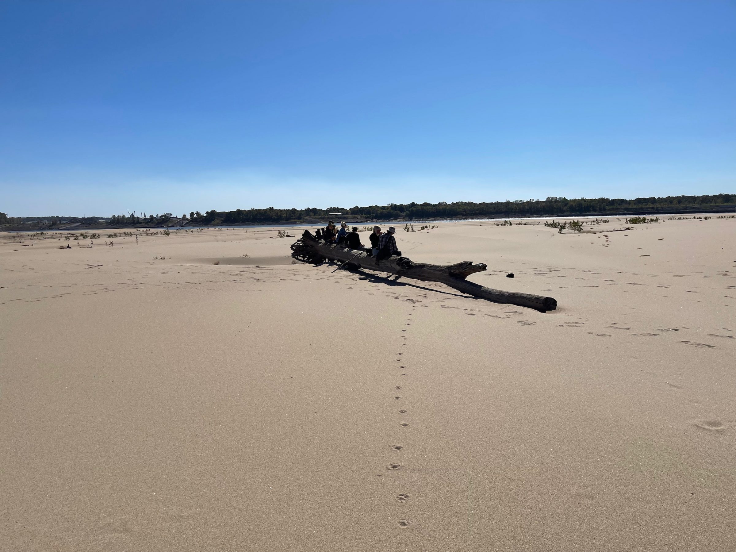
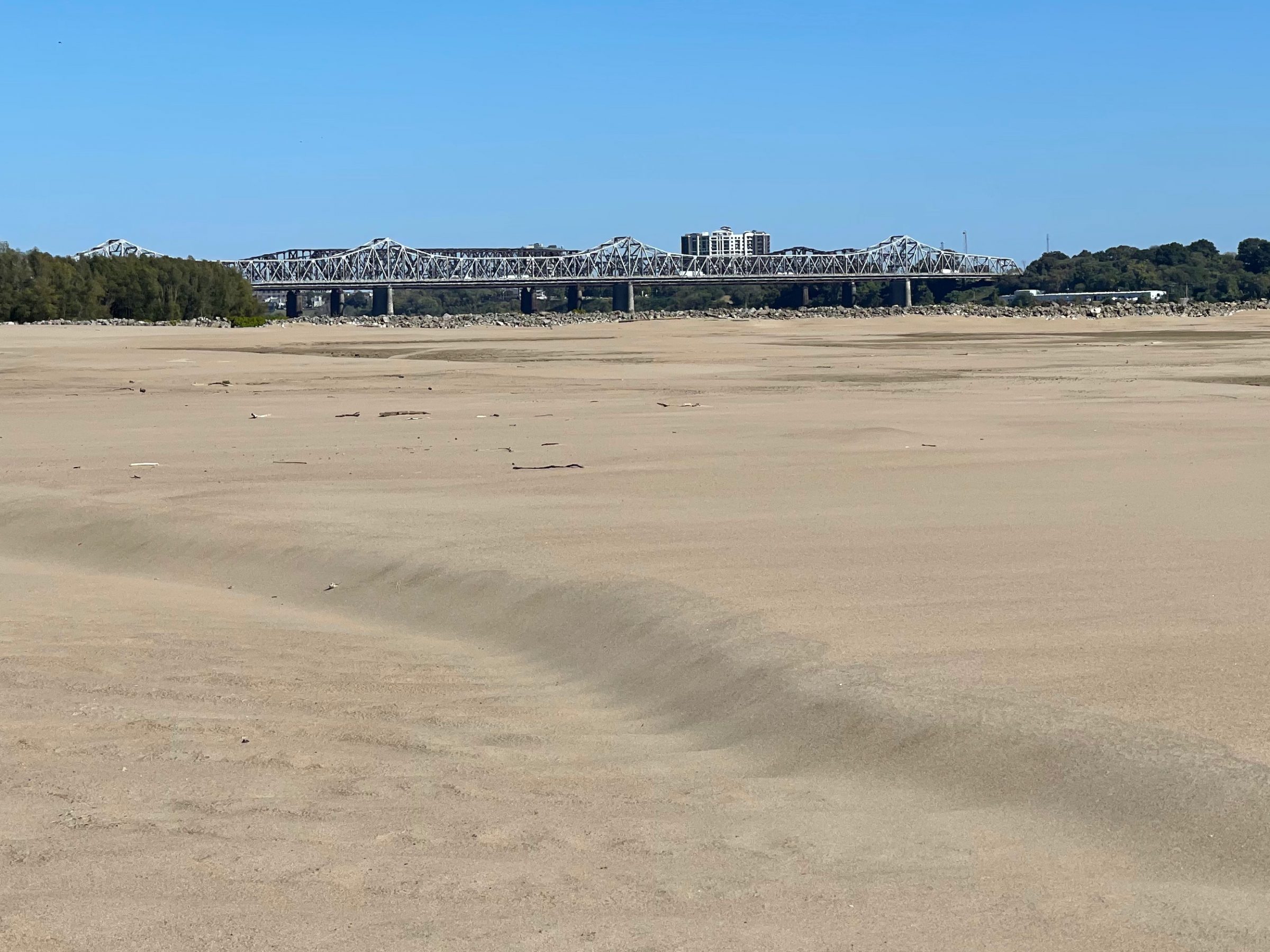
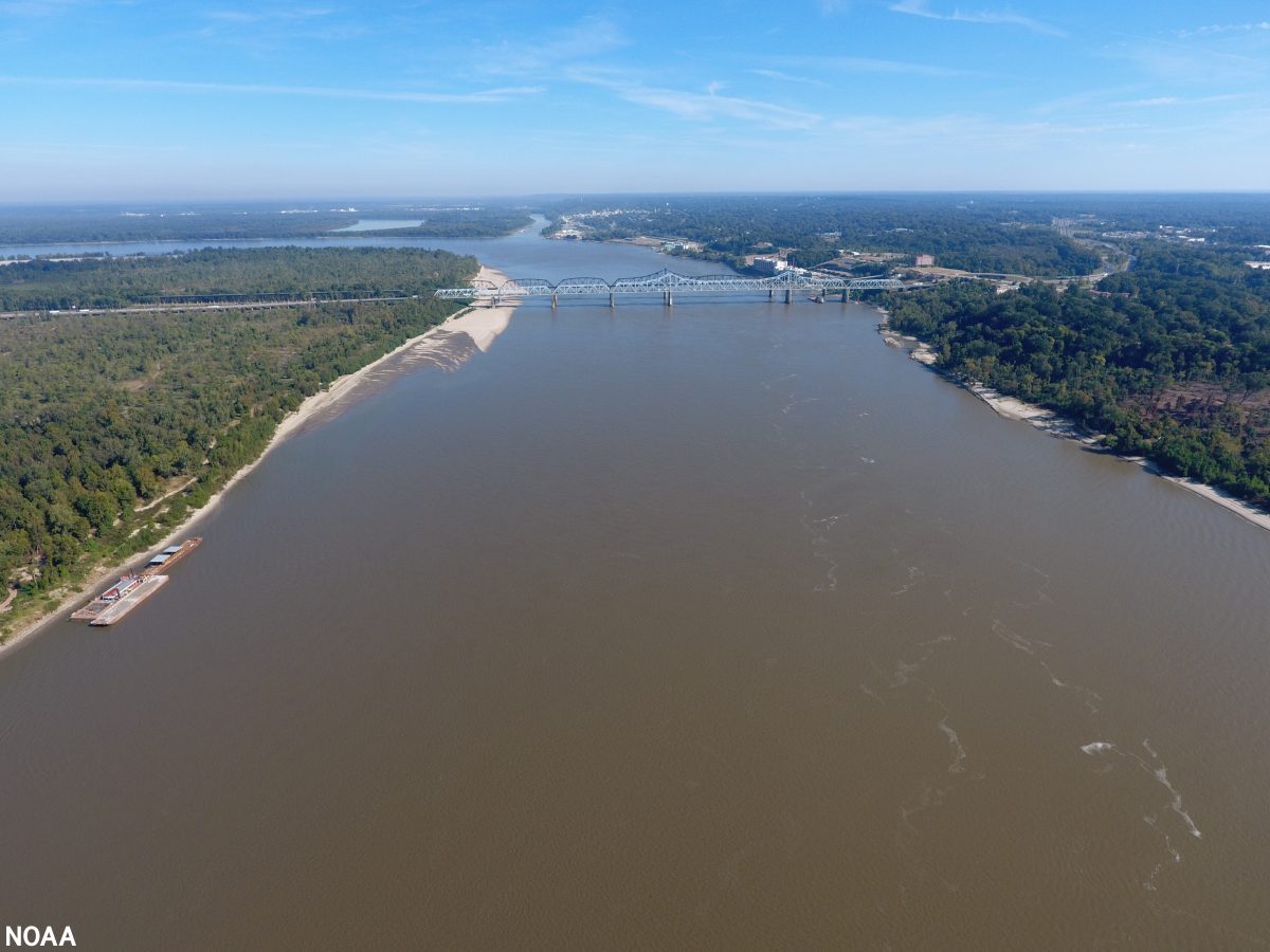
West Tennessee farmers struggled to get crops to market because of the record-low level of the Mississippi River.
November
Groups asked state officials for a special investigator to review the “very real failures that led to [Eliza] Fletcher’s tragic murder.”
A group wanted state officials to change the name of Nathan Bedford Forrest State Park.
The Tennessee Supreme Court ruled that mandatory life sentences for juveniles were unconstitutional.
A plan to forever end parking on the Overton Park Greensward was finalized by city leaders, the Memphis Zoo, and the Overton Park Conservancy.
December
The Commercial Appeal dodged layoffs in the latest round of news staff reductions by Gannett.
Federal clean-energy investments will further ingrain Tennessee in the Battery Belt and help develop a Southeast Regional Clean Hydrogen Hub (H2Hubs).
The American Civil Liberties Union of Tennessee criticized Methodist Le Bonheur Healthcare (MLH) for canceling gender affirmation surgery for a 19-year-old patient.
State and local officials investigated an alleged milk spill into Lick Creek.
MLGW rejected Tennessee Valley Authority’s (TVA) 20-year rolling contract but will continue to be a TVA customer “for the foreseeable future.”
Former state Senator Brian Kelsey’s law license was suspended after he pled guilty to two felonies related to campaign finance laws last month.
Visit the News Blog at memphisflyer.com for fuller versions of these stories and more local news.


