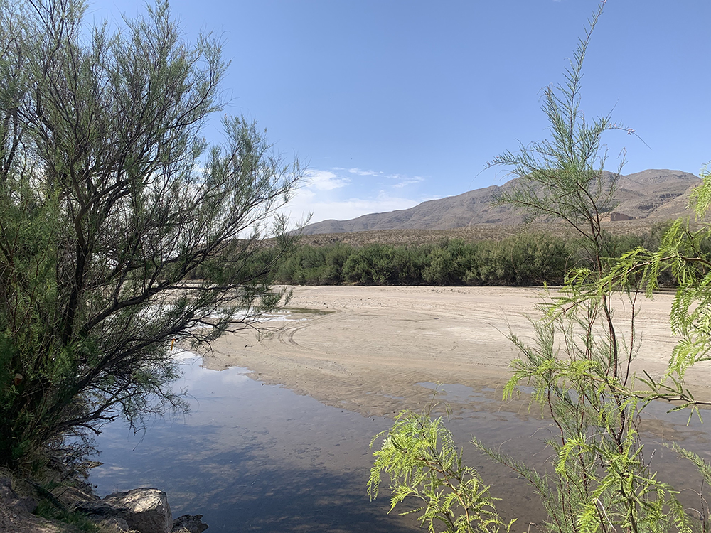
I crossed the Rio Grande river last week — several times, actually. It wasn’t that difficult. In fact, I could have walked across and not gotten my feet wet, much less my back.
In Las Cruces, New Mexico, where I was visiting family, the Rio Grande comes down from the northern part of the state and runs along the city’s western edge. Or at least it used to. Right now, the Rio Grande is as dry as a buzzard’s brunch — a 100-yard-wide strip of sandy dirt. The river has looked like this in Las Cruces from October to February for most years since the 1990s. The Rio Grande is “turned on” again early each spring by releasing water from the Elephant Butte Reservoir 70 miles upstream.
But things are changing, and not for the better. In 2020, water wasn’t released into the Rio Grande bed until late March, and the river was back to dirt by September. This year, the Elephant Butte Irrigation District says levels are so low that water won’t be released until June, and that the river will probably be dry again by the end of July. In New Mexico, the Rio Grande is no longer grande — or even a rio — for most of the year.
Historically, the Rio Grande used to flow year-round through the Mesilla Valley from Hatch (Chile Capital of the World), through Las Cruces, down to El Paso, at least at some level. Before the Spaniards arrived, Native Americans farmed the valley and fished the river’s waters. Then as agriculture began to increasingly tap into the river in the 20th century, the Rio Grande was dammed in several places to prevent seasonal flooding, capture snow-melt runoff from the mountains, and provide water as needed to irrigate many thousands of acres of pecans, alfalfa, lettuce, chiles, onions, and cotton. Now, there is enough water for agriculture — maybe — but that’s about it.
South of El Paso, where the river becomes the border between the United States and Mexico, the water level picks up again somewhat, as the river is fed by reservoirs in both countries. But drought (which doesn’t recognize lines on a map) is also affecting flow along the border.
It’s a good thing we have that beautiful 2,000-mile wall. Or, actually, I guess it’s the 452 miles of fencing that were already in place, plus the 80 miles that the Former Guy added. According to Google, there are 300 or so miles of barrier (fencing or wall) along the dry border between San Diego and El Paso. After that, we’ve traditionally counted on the Rio Grande to handle the job of stopping would-be immigrants: making them swim for it or die trying. We may have to rethink that strategy. Wading isn’t all that dangerous.
But I digress. Las Cruces is a lovely place. It has beautiful scenery, and it’s fun to drive around and take in the vast vistas of sky and mountains. (And also to drive into the desert with my brother and shoot at Amazon boxes using my late father’s old .22. We killed several.)
On a whim, I took my tack-sharp 95-year-old mother on a drive north of Las Cruces, through the farm fields of the Mesilla Valley to Radium Springs, where there is actual water flowing in the middle of the desert and where some of the world’s largest pecan orchards are located. We veered off toward the Rio Grande on a gravel road and found a couple of small, shallow pools in the riverbed — a lovely reminder of what used to be, and, sadly, probably not a harbinger of what’s to come.
In fact, if what I saw in Las Cruces is any indicator of where we’re headed with the Rio Grande, keeping the scary hordes of brown people from invading our pure Anglo-Saxon soil is just going to keep getting harder. It’s clear that Mother Nature — or climate change, if you’re an elitist — is conspiring against our puny idea of what makes a border.
It may come down to a choice between saving American pecans or keeping a few American wing-nuts happy. I stand with the pecans.
