Categories
News News Blog News Feature

Whatever Happened To: the Greenline Extension From Tillman to Tobey Park

Whatever happened to the project to extend the Shelby Farms Greenline west from Tillman? 

For the third installment of our occasional series, called “Whatever Happened To,” we’re checking in on that project. The $5.3 million plan was announced in 2016, nearly six years ago, and no construction has yet to begin on it. 

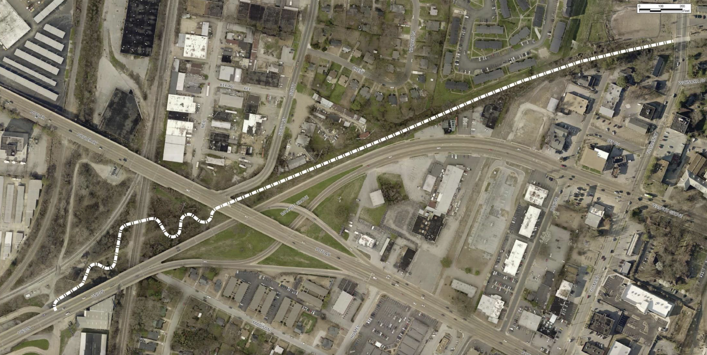
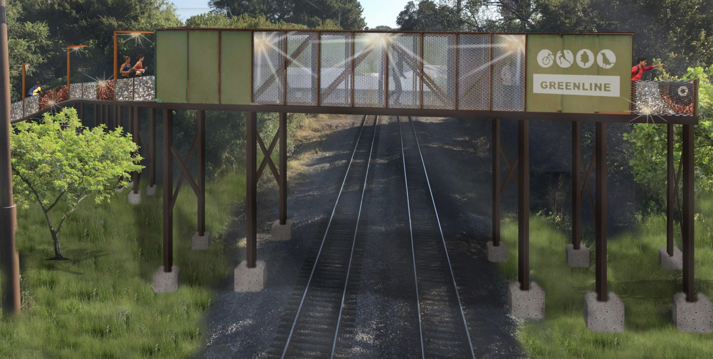
Here’s how the project was described by the city of Memphis Bikeway and Pedestrian Program’s website in October 2016: “The scope of this project is from the Greenline’s current terminus at Tillman Street to Flicker Street. Due to the necessity of crossing an active railroad, the city will construct a bicycle and pedestrian bridge in between the Union Avenue and Poplar Avenue viaducts. 

“Additionally, the city intends to build a new trailhead at Flicker Street, under or near the Union Avenue viaduct. Once complete, the bridge will allow the Greenline to one day push through Tobey Park, into the [Mid-South Fairgrounds], and possibly beyond.”

Since then, three different people have occupied the White House, a two-year pandemic changed the world, and The Fairgrounds is now called Liberty Park. 

For answers on the delay, we turned to Nicholas Oyler, manager of the city’s bike and pedestrian program. 

Memphis Flyer: Whatever happened with this project?

Nicholas Oyler:  This one is also federally funded. So, it’s also beholden to those same environmental clearance requirements [as the Poplar-Cooper Connector] and there are some other formalities that must be met. 

Ah, okay.

There’s also acquiring a formal railroad right of way. The project involves building a bridge over an active railroad. Anytime there’s a railroad involved, there’s even more legwork that has to be done, more boxes to check.

(Credit: City of Memphis)

We’ve been in that environmental review phase ever since the project started. The good news on this one is that we received that environmental clearance just last August. 

So that cleared the way for the project to proceed with design work. The engineering design consultant has finished 60 percent of the construction plans, so we have the preliminary plans. Those will get reviewed by the state and by us internally. 

We will be meeting with project stakeholders probably in the next three to four months. We’ll start talking about more of the amenities, the landscaping, opportunities for public artwork, and that sort of thing.

Kind of similar to [the Poplar-Cooper Connector], we anticipate we’ll be reaching construction mid-2023. 

Have the plans changed?

 Currently, the Shelby Farms Greenline stops at Tillman Street on the west side. This project will push it further to the west. So, it’s going to continue past Tillman, where it currently ties in with the Hamp Line. 

A conceptual drawing of how the bridge could look. (Credit: City of Memphis)

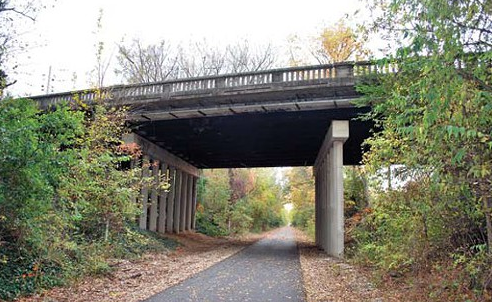
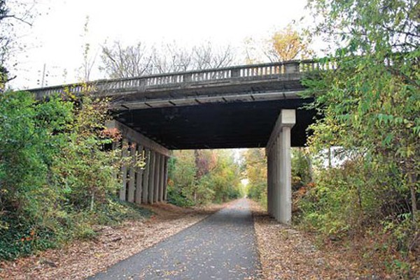
It will continue past Tillman, go under the Poplar Avenue viaduct, and then kind of rise up, become elevated to go over those active railroad tracks that the Union Avenue viaduct goes over. It will come down and then land at Flicker Street, near the skate park and Tobey Park. 

It is moving forward. Like I said, we expect construction to begin on this in mid-2023. 

A conceptual drawing of new life under the viaducts under Poplar and Union. (Credit: City of Memphis)

Is there anything I left out or anything you’d like to add?

On a related note, we have since received a separate federal transportation grant that allows us to start studying the feasibility of continuing a connecting path. It probably won’t be the Greenline as we know it, meaning it won’t necessarily be a separated, off-street path. 

 But we’re developing some kind of connection for people walking and people biking to continue from Flicker Street farther west to Cooper Street in Midtown. This one is just starting. It’s much earlier in the whole process. At this point, it’s just a feasibility study. But that’s another exciting connection that’s underway. 

A conceptual drawing of a bike and pedestrian bridge over East Parkway to help connect the Greenline to Downtown. (Credit: City of Memphis)

The bigger picture here is we have this Greenline project in the works already. Then, like I said, there’s the segment between the Greenline and Flicker that is [coming together]. Then, you have the Peabody Avenue project, which is going to link up with the existing bike lanes on [Martin Luther King Avenue] that we did a couple of years ago. 

One day, once this Cooper and Flicker segment of the Greenline is finished, we’ll have a continuous, seamless corridor running all the way from Downtown out to Cordova. It’ll be a corridor about 30 miles long.

Categories
News News Blog

People Are Biking, Walking More Amid Pandemic

Facebook/Big River Crossing


The number of people biking and walking here is higher than usual, according to new data from the city.

The city’s Bikeway and Pedestrian Program looked at data from nine automatic bicycle and pedestrian counters installed at different spots around the city that revealed a surge in activity, largely corresponding to the city’s Safer-At-Home order issued in late March.

The counters located in parks, along trails, and on city streets detect passing bikes and pedestrians to provide a total count of both modes or a combined count.

Overton park closed to car traffic in late March and began tracking bikers and walkers at its primary access points and the Old Forest gateways earlier this year. At the Old Forest Gateway near Rainbow Lake there has been a huge jump in bicycle activity since late March.

From the third week in March to the third week in April, the number of cyclists counted per week at that spot jumped by 2,000 users. While cyclist numbers hovered around 2,000, pedestrians counted were close to 6,000, according to the data.

On the graphs below, the Overton Park’s Tucker Street access point off of Poplar Avenue is referred to as Tucker, the Old Forest entrance near Rainbow Lake is dubbed Tyler, and the entryway along East Parkway is called Ben.

City of Memphis


On Big River Crossing, traffic increased to numbers similar to those in the spring following its opening. Counters along Big River Crossing were installed in fall 2016 and have been tracking traffic ever since.

This year, cyclist numbers began similar to that of last year, but by the second week of March, traffic was higher for that week than the same period in any previous year. And by the fifth week of March, the bicycle counts were more than double the average for that period with a total weekly count of 1,245. Last year, less than 400 users were recorded during that week.

City of Memphis

There are multiple counters along the Shelby Farms Greenline. Where the Greeline meets Germantown Parkway, a counter recorded a spike in activity beginning in the last week of March. Usage between late March and the end of April was, on average, 160 percent higher than the same period in 2019.

City of Memphis

Moving west, the counter along the Greenline at Farm Road tracked an average of 5,000 cyclists and pedestrians per week between the last week of March and the end of April. From the fourth week in March to the next week, there was close to a 200 percent increase in activity.

City of Memphis

Even further west, the Greenline counter near Highpoint Terrace recorded more than 7,000 users from late March through April. This is nearly double the average use for this time period.

City of Memphis


The segment of Wolf River Greenway that runs parallel to Humphreys Boulevard has seen the highest usage since tracking began in 2014. Compared to the previous five years, springtime usage climbed more than 80 percent on that portion of the Greenway. In the last week of March alone, nearly 6,000 cyclists and pedestrians were counted, compared to about 2,500 during that period last year.

City of Memphis

The city installed an on-street bicycle counter on Florida Street near Crump in 2017. While traffic recorded by this counter is in line with previous years during late February to late March, the first week in April shows a huge spike in usage. The count for that week was 64 compared to 22 in 2019 and 13 in 2018.

City of Memphis


Explore Bike Share began offering free 60-minute rides for 30 days on March 20th and recently extended the offer through May 20th. In the initial 30 days of the campaign, “Let’s Ride This Out,” check-outs from EBS’ top 30 stations usage increased by 54 percent compared to the month prior. Of those checkouts, close to 85 percent were new EBS users.

Categories
Cover Feature News

Wolf Tracks

The Huntington Hills apartment complex in Raleigh looks like any other slightly distressed complex in the city’s inventory of aging, blighted apartment communities. Some of the multi-family buildings in the gated complex are occupied, with bright red flowers sprouting around the walkways and cars parked out front. But other buildings on the site are boarded-up, mini-ghost towns without a single car parked outside.

Out of the back windows of one of the boarded two-story buildings, residents (if the building had any) would have sweeping views of the serene Wolf River, surrounded by thick patches of woods.

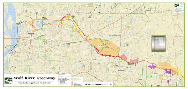
In a few years, those residents would have back-door access to the future Wolf River Greenway (WRG), a 36-mile walking and cycling trail that will follow the path of the Wolf River from Collierville to Mud Island. The Wolf River Conservancy (WRC) broke ground on a 20-mile Memphis stretch of the trail in late September, and they plan to have the entire path constructed by 2019.

Deborah Newlin, a Sabal Financial Group asset manager, represents the California-based bank that owns Huntington Hills, which is only 51 percent occupied and went into foreclosure earlier this year. They’re starting renovations on the units’ interior now, and the exterior will be revitalized in 2016. Thanks to the greenway plans, Newlin sees potential for the property and the surrounding Raleigh community.

“Asthetically, [the greenway] will add beautification, and it will add a better sense that this is a safe place to come to,” Newlin said.

Huntington Hills is just one stop on the WRG, which will be the only continuous trail leading from one end of the county to the other. Since the greenway will follow the path of the Wolf, much of it will run through uninhabited areas — wetlands, thick woods, and other natural gems hiding in the city’s urban core. Other portions will traverse impoverished communities, providing a new transportation route for low-income residents without cars. And it will provide connections to the Shelby Farms Greenline and other bike lanes.

The Greenway Today

“We believe we’re building a corridor of opportunity,” said Keith Cole, executive director of the WRC. “It’s more than just a 12-foot-wide paved hiking and biking path. As we go through these diverse neighborhoods — downtown, Midtown, Raleigh, Frayser, East Memphis — we can just imagine increasing the connectivity of those neighborhoods.”

The 20-mile or so city stretch of paved path will add a western connection to the existing 2.6-mile stretch of the WRG, which runs from Walnut Grove to Shady Grove along the southern bank of the Wolf and was completed in 2010. In 2012, it was extended eastward to connect with the Germantown Greenway running adjacent to Humphreys Boulevard.

and after (below).

Although the Germantown Greenway is maintained by the city of Germantown, it follows the path of the Wolf, and the WRC considers it part of their continuous WRG system. Germantown is currently planning to extend its greenway 2.5 more miles to Cameron Brown Park, making it only a mile away from a connection with a planned segment in Collierville.

Between April 13th, 2014 and April 13th of this year, the city counted more than 187,000 cyclists and pedestrians on the WRG.

“Our counts grew by 100 percent when we connected the greenway with Germantown,” says Bob Wenner of the Wolf River Conservancy. “So what happens when we connect with the Shelby Farms Greenline or with bike lanes in other parts of the city? The potential is there for it to come to a million users a year on the Wolf River Greenway.”

The Master Plan

The proposed WRG will begin at the head of the existing greenway near Walnut Grove. From there, it will run northwest along the border of Shelby Farms Park and continue northwest to Kennedy Park, a 260-acre city park in Raleigh with nine baseball fields and two soccer fields.

Kennedy Park is where the WRC held its late September groundbreaking event.

“Kennedy Park is a beautiful park. It’s one of the largest in the city, and it represents the heart of this project,” Cole told those gathered in the park that morning.

From there, the greenway will follow the path of the river to Epping Way, a 66-acre abandoned Raleigh country club that’s now an overgrown natural area with wooded areas and a lake. The trail moves southwest and connects with Rodney Baber Park, an underused 77-acre city park with seven softball fields and one baseball diamond.

“In the ’70s and ’80s, [Rodney Baber] was a really busy place. A lot of people played softball there,” said Mike Flowers, administrator of planning and development for the city’s Division of Parks and Neighborhoods. “But into the ’90s, the park started experiencing a lot of car break-ins at night. Play dwindled to the point that it’s not really used now.”

The May 2011 flood destroyed the sports lighting, concession buildings, and restrooms at Rodney Baber; they were under five to seven feet of water. Flowers said the city is seeking grant funds from the federal Department of Housing and Urban Development’s Disaster Resilience Competition to make those repairs.

West of Rodney Baber, the greenway moves through North Memphis, adding a connection to the Chelsea Greenline, and then over to the northern tip of downtown. The WRC controls 80 acres of land on the north end of Mud Island, and they’re proposing a new park at the greenway’s end at the Mississippi River.

“There’s all this land and incredible views of the Mississippi River, so we thought ‘Why don’t we call it something besides Mud Island?’ It’s the confluence of the Wolf and Mississippi Rivers, and we kind of like the name Confluence Park,” said Bob Wenner, WRC greenway coordinator. “It’s one of those Kodak spots. It’s a great place to watch the ships come up and down the Mississippi.”

The WRG has a price tag of about $40 million. So far private foundations have committed $22 million, including a $5 million challenge grant from Hyde Family Foundations.

“One of our big priorities is connecting people through green assets, streetscapes, and transit,” said Lauren Taylor, the program director for Livable Communities at the Hyde Family Foundation. “I think this is so exciting, the sheer fact that it’s going through so many different neighborhoods from downtown to Frayser to Raleigh to Shelby Farms Park. There are so many sections that will be close to schools and churches.”

Some funding will come from the city, which has already committed $7.5 million over the next five years. The WRC has acquired another $1.6 million from the Tennessee Department of Transportation. They’ve raised $568,000 in individual donations. Cole said the WRC will go public with a capital fund-raising campaign in mid-2016 when they “start turning dirt.”

Epping Way

Just up James Road from Huntington Hills, tucked away on a dead-end road between two large apartment complexes, are two crumbling pillars flanking a padlocked gate. Once you step over the low gate, you’re led into a massive natural area.

There are worn, paved streets, but they’re closed to traffic, and nature has begun to reclaim them. A short walk along the pavement leads you to the foundation of an old building. Some of the vintage tile from the rooms that were once inside the long-gone structure remains. Ornate tiles with a floral pattern outline an area that may have been an old swimming pool.

Epping Way: before (above) and after (below).

There are overgrown tennis courts and a massive lake, where those in-the-know about hidden Memphis fishing holes come to get away from hustle and bustle of the city. The sounds of nearby traffic along James Road are completely blocked by the rustling whisper of blowing leaves and bird songs. The Wolf River runs nearby, just on the other side of the lake.

This is Epping Way. Its history is a bit of a mystery, but it’s believed to be the site of an old country club and the historic home of Berry Boswell Brooks, a big-game hunter whose exotic kills — lions, hippos, and other wildlife — were displayed in the Pink Palace Museum in the 1950s.
The WRC acquired the 66-acre site (and 55 additional acres surrounding it), and the planned WRG will run through it. Cole and Wenner are hoping to eventually turn the area into Epping Way Nature Center and possibly even move the WRC headquarters to the site from their office building in Midtown.

“Our primary goal is to get the trail in, but [Epping Way] could become an environmental center, maybe like the Lichterman Nature Center. But it would be more of an outdoor classroom,” Wenner said. “You’ve got a river, a lake, and a wetland there. Maybe we could train adults and children in using canoes on the lake, and once they’re comfortable, we could move them to the river.”

The Design

The WRC plans to build the greenway in short segments, and a one-mile segment through Kennedy Park is slated for development first.

“It will be controlled chaos for awhile. It will be all over the place, but eventually, it will all come together,” said Chuck Flink, a senior advisor at Alta Planning+Design, which is working on the greenway design.

Flink has worked on greenway projects across the country, including the Grand Canyon Greenway and the Northwest Arkansas Razorback Regional Greenway, a 36-mile trail near the University of Arkansas in Fayetteville.

Flink says the WRG will be a paved trail, so it will be accessible to cyclists, walkers, runners, wheelchairs, and baby strollers.

“We’ll have lots of boardwalks and bridges. I like to refer to it as changing the plane, so you’ll get above the tree-line or above the surrounding ground in places. That gives people different things to experience [along the trail],” Flink said.

Connecting Memphis

Clark Butcher, owner of Victory Bicycle Studio on Broad, said the greenway will provide a safer east-west connection to get cyclists and pedestrians across the city. Right now, Butcher said cyclists have to use a variety of protected and unprotected bike lanes and trails, some of which require cyclists to share the road with vehicles.

“There’s a huge false sense of security when it comes to bike lanes,” Butcher said. “But what the WRC is doing is providing a dedicated and protected lane. You’re off-road, and it’s not wide enough for a car.”

Cole and Wenner are hoping the greenway will appeal not just to cyclists who would use the trail for recreation, but also to lower-income Memphians who may not have access to a car.

“This will also become a low- to moderate-income transportation corridor, and there will be linkages with MATA bus lines,” Wenner said. “Somebody may bike to a certain point and then ride the bus the last mile to work or school.”

“The route will go through a lot of underserved neighborhoods,” adds Cort Percer, the Mid-South Greenways coordinator. “These are areas that are underserved in terms of access to green space, healthy food, transportation, recreation, and exercise opportunities. The greenway will be a path around the barriers — I-40, high-traffic roads — that have created this access problem.”

Alta Planning+Design’s study on the economic and health benefits of the WRG found that of the 100,000 residents living within a 10-minute walk of the proposed greenway, 2,500 were without access to a car, and 5,000 were below the poverty line.

The WRC is hoping to positively impact the health of the city by giving people better access to walking and biking trails.

In Memphis, 35 percent of the population is obese, and the diabetes rate is 50 percent higher than the national average. According to the Alta Planning+Design survey, the Memphis region will gain 1.19 million miles of walk trips and 1.25 million miles of bike trips once the greenway is complete. The survey found that the overall economic impact of the greenway will equal $14 million in combined health, transportation, environmental, and economic benefits.

But it isn’t just about connecting Memphians to walking trails and alternative transit. The greenway is also being designed to bring residents, who may not even know how to access the Wolf today, closer to the river. Better boat access to the Wolf is part of the master trail plan.

“We already have a very active recreational outreach program with 50-plus volunteer river guys who take people up and down the Wolf every year,” Cole said. “We could envision similar activities along the greenway, engaging neighborhoods and schools.”

At the end of the day, the WRC, which celebrates its 30th anniversary this year, is a land trust charged with conserving and enhancing the Wolf River by protecting the lands that surround it from future development. Cole and Wenner believe that building the WRG is the ultimate way to conserve and protect the river for years to come.

“We have this river, this asset, floating through our city,” Wenner said. “This is what we do to make it better. This is how we connect people to the river.”

Upcoming Open House Public Meetings on the Wolf River Greenway; all run from 5-8 p.m.: Oct. 20th – The Office @ Uptown (594 N. Second); Oct. 21st – Hollywood Community Center (1560 N. Hollywood); Oct. 22nd – Ed Rice Community Center (2907 N. Watkins); Oct. 27th – Raleigh Community Center (3678 Powers); Oct. 28th – Bert Ferguson Community Center (8505 Trinity)

Categories
News The Fly-By

Bicycle Crossing Light Planned for Hampline

Earlier this month, a bicyclist was killed after being hit by a vehicle just a block west of Sam Cooper and Tillman, the same intersection that, in about a year, will boast the city’s first bicycle-only traffic light.

The special traffic signal for cyclists is part of the planned Hampline bicycle path stretching from Overton Park to the Shelby Farms Greenline.

Zachary Walls, 40, was hit and killed by a vehicle driven by 50-year-old Solomon Johnson. Johnson stayed on the scene but was arrested for driving on a suspended, revoked, or canceled license. The scene of the accident was closer to Lipford, about a block from the traffic light at Tillman, so it’s hard to know whether the completed Hampline and its planned bike traffic signal could have made his route safer.

But Livable Memphis Program Director John Paul Shaffer believes the planned bike path will improve bicycle and pedestrian safety overall.

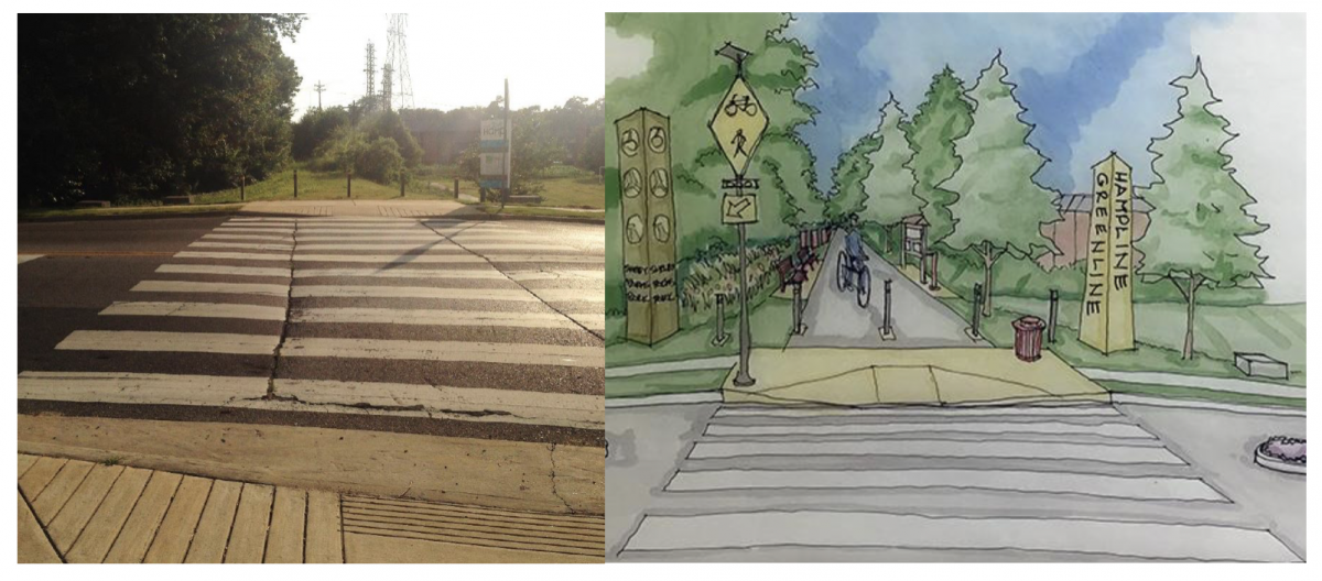
Artist rendering of the Hampline along Tillman

“Sam Cooper right now screams ‘You’re not safe no matter what happens,'” Shaffer said. “Getting across Sam Cooper is terrifying sometimes.”

Once complete, cyclists will approach the Sam Cooper and Tillman traffic signal, and a sensor in the street will detect the bike. An extra traffic signal with red, yellow, and green lights projected through a cutout of a bicycle will tell cyclists when it’s safe to cross.

Part of the Hampline is already constructed. It begins at Overton Park and crosses East Parkway onto an existing sidewalk along Sam Cooper that leads to Broad Avenue. From there, the path travels down Broad’s existing bicycle lanes.

In the past few months, city crews have erected flexible bollards along Broad between Hollywood and Collins to separate the lane from the parking area. Before those were installed, drivers would often park cars partially inside the bike lane. City Bicycle and Pedestrian Coordinator Kyle Wagenschutz said crews are still putting the finishing touches on that stretch of the Hampline project.

“They’re about 85 percent done. They can only operate on days when it’s warm enough to put the paint down,” Wagenschutz said.

But for now, the Hampline ends at Collins. That’s because that first stretch of the Hampline was paid for through city funds, but the rest of the project — the lane from Collins to Tillman, the bicycle traffic signal at Sam Cooper and Tillman, and the north-south stretch of lane from Tillman to the Greenline — will be funded using federal money.

The designs must be approved by the Tennessee Department of Transportation and the federal government before that part of the project can move forward.

“If the design approval process goes smoothly, we’ll be able to bid the construction for those [final] phases sometime in 2015, but whether or not the physical construction begins before next winter, I don’t know at this point,” Wagenschutz said.

From Collins west to Tillman and from Tillman south to the Greenline, the lane will be buffered from traffic with a concrete median, some of which will be planted.

“I think there’s even a rain garden in one spot. It just depends on how wide they are as to whether or not the curbs have plantings,” said Shaffer, whose organization raised $72,000 for the Hampline’s design through the crowd-funding website, ioby.org.

Despite the recent bicycle fatality near the Hampline’s path, Wagenschutz said bicycle accidents have actually decreased since 2008. Most years, the city only has one or two accidents. So far this year, there have been two, both within the past month. The city doubled the miles of bicycle infrastructure by 2010, and that number is projected to double again by 2016.

Categories
News The Fly-By

Bike Repair Stations Now Ready at Shelby Farms Park 

Four new bicycle repair stations are now ready for cyclists around Shelby Farms Park, further evidence of the city’s deepening investment in bike infrastructure.

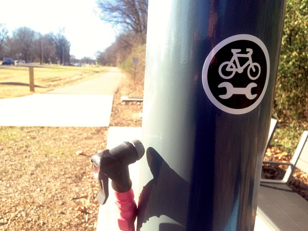
The stations are about five feet tall and feature a bike pump, a hands-free bicycle mount, and the tools required for basic repairs. Not a bike mechanic? Get out your smartphone and scan a QR code on the side of the station for step-by-step instructions. The stations are all free to use.

Toby Sells

Bike repair station at Farm Road and Mullins Station

The repair stations are located at the Shelby Farms Greenline trailhead (at Farm and Mullins Station), the Tour De Wolf trailhead, the Germantown Greenway trailhead, (close to the corner of Wolf River Boulevard and Germantown Parkway), and at the Wolf River pedestrian bridge (near Shady Grove and Humphreys).     

Each of the Dero Fixit stations retail at $800 on the Dero website. The Shelby Farms project was funded mainly through a partnership between Shelby Farms Conservancy and Conway Services, a Memphis air-conditioning and plumbing company. The company’s owner, John Conway, said in a statement that his involvement was to simply make “our city be a healthier and more pleasant place to live.”

Though the stations aren’t a multi-million-dollar blockbuster project, they are part of a larger, fundamental change in the way Memphis leaders are thinking about transportation. Miles of bike lanes are now striped throughout the city. The Harahan Bridge project will carry cyclists and pedestrians across the Mississippi River next year. The long-awaited Mid-South Regional Greenprint plan proposes 500 miles of new greenways to connect Shelby, DeSoto, Crittenden, and Fayette counties.   

“We want to do anything we can to encourage pedestrian access to [Shelby Farms Park],” said Cameron Mann, manager of corporate development and communications for Shelby Farms Conservancy. “Prior to the [Shelby Farms Greenline], the only access was with a motorized vehicle. So, the Greenline was a game-changer for us.” 

Mann said the conservancy began working on the project about a year ago. The planning process included interviews with leaders in the bicycling community, like those with bike stores, repair shops, and bicycle clubs. They all wanted repair stations, Mann said, for a more assuring ride in case their chain fell off or tire went flat.

Clark Butcher, owner of Midtown’s Victory Bicycle Studio, said he sees hopeful symbolism in the stations.

“It’s a permanent fixture,” Butcher said. “The things are anchored to the ground. They aren’t going anywhere.”

Bike repair stations have popped up in cities and college campuses across the country in recent years. Leaders have embraced bicycling culture and hope to engrain it in the overall transportation mix of their communities. 

Stations similar to those in Shelby Farms Park are now in place in cities from New Haven, Connecticut, to Salem, Oregon. They’re also on college campuses from Rutgers to Texas Tech. Repair stations are already in place in North Little Rock along the Arkansas River Trail and close to the Big Dam Bridge.

Categories
News The Fly-By

Expanding Greenline To Midtown Will Involve Building Bridge

There’s a plan to extend the Shelby Farms Greenline to Midtown, but there’s a big hurdle — make that two big hurdles — in the way.

Two active rail lines are blocking the planned path of the greenline extending west from Tillman to its eventual end at Tobey Park.

“It’s the same rail line that runs adjacent to Wiseacre [Brewing Company on Broad]. The trail alignment runs in a diagonal to the existing rail lines there,” said the city’s bike and pedestrian coordinator Kyle Wagenschutz.

The solution is to build a bridge over the live rail lines, and the city has received a federal transportation grant for the initial design work. That money will fund an analysis of potential environmental hazards of building a bridge, any drainage issues, and how it will fit underneath the Poplar viaduct and over the railroad.

“At this point, there have been no funds committed for actual construction. We know it will be expensive, several million dollars,” Wagenschutz said. “We’re hoping the next time the federal funding cycle comes around, we’ll be able to request funds. But we have a couple of years.”

He said the city will likely begin the process of selecting a design firm for the bridge in the spring or summer. Right-of-way for the quarter-mile from Tillman to Tobey Park was included in the existing greenline’s right-of-way purchase from CSX Railroad. The current seven-mile greenline is built along an abandoned CSX rail corridor.

In March, construction is expected to begin on the greenline’s eastward expansion. Earlier this month, the Shelby County Public Works Division negotiated a contract with CSX Railroad to purchase the deserted right-of-way from Farm Road to the old Cordova train station on B Street.

“Residents in Cordova have been asking for a better connection to the park for quite some time,” Wagenschutz said. “I think this will be a great addition, particularly in helping to connect a large population of users to the park without them having to drive their cars over.”

Federal grants will cover 75 percent of the cost. Shelby County government allocated $650,000, and the remaining $550,000 was donated by the Shelby Farms Park Conservancy. 

There were a couple of smaller hurdles in the path of the 4.1-mile eastward expansion. In one area, an older trussle bridge must be replaced, and other areas will require improved pedestrian crossings.

“The biggest issue is safe crossing of Germantown Parkway,” said Laura Morris, executive director of the Shelby Farms Park Conservancy. “That was resolved by a design that the city and county engineers came up with to add back the red light at the railroad track [between Macon and Fisher Steel] that was once there when it was a live rail crossing. It will be timed with the two traffic lights close by at Macon and Fisher Steel so it doesn’t have any effect on the traffic.”

Pedestrians will cross the greenline at Germantown Parkway at two signals. First, they’ll cross onto a protected median in the middle of the parkway. They’ll have to push a signal button at the median and wait to cross the other half.

Eventually, the plan is for the greenline to extend east to Oakland, but some of the land along the former rail line to the east belongs to individual landowners.

“The next piece of [the greenline’s expansion] that will take you to the Fayette County line is going to involve patching back together the landowners’ portions of the right-of-way,” Morris said. “But we have had indications from many of the landowners that they would be willing to work with the county.”

Categories
News News Blog

Shelby County Gets Permission To Extend Greenline

Screen_shot_2014-11-24_at_10.41.24_AM.png

The Shelby Farms Greenline will be soon be extended a few more miles to the east.

A contract has been negotiated between the CSX railroad and the Shelby County Public Works Division to purchase the deserted right-of-way from Farm Road to the old Cordova train station, allowing the greenline to extend four more miles. Once the project is complete, the greenline will be 10 miles long.

Currently, the former rail line turned jogging and cycling path runs from Tillman on the west to Farm Road on the east. The total cost for the greenline so far has been $4.8 million, 75 percent of which has been covered by federal grants. The rest was allocated from Shelby County government or donated from the Shelby Farms Conservancy.

“This is another significant step to provide our community a first-class recreational route for walkers, joggers, and bikers. It will encourage physical fitness and provide a unique way to link our neighborhoods,” said Shelby County Mayor Mark H. Luttrell, Jr.

“We’re pleased Mayor Luttrell and his staff at Shelby County Government have successfully negotiated the contract with CSX, and we look forward to assuming the management of this section of the Shelby Farms Greenline. Indeed, this is another major development for the Shelby Farms Park Conservancy. The Greenline extension through Cordova will bring even more people to the wonderful recreational assets we provide,” said Laura Morris, executive director of Shelby Farms Park Conservancy.

The Shelby County Commission must approve the railroad right-of-way contract before bids can go out for construction. That is expected to happen in early 2015, and construction should begin next spring.

Categories
News The Fly-By

Greenprint Plan Proposes 500 Miles of Greenways

A plan will soon move forward that could eventually connect Shelby, Crittenden, DeSoto, and Fayette counties with a network of 500 miles of greenways. 

It’s the first recommendation from those who have guided the Mid-South Regional Greenprint plan for the past three years. 

Shelby County won $2.6 million in 2011 from the U.S. Department of Housing and Urban Development to develop a long-term vision for the area’s green spaces, including parks, greenways, community gardens, storm water management, and waterways.

The planning process has so far included 80 organizations, 18 municipalities, four counties, three states, and input from thousands of residents, as well as civic and business leaders.

Bianca Phillips

The overall plan is broad, covering everything from fair housing to bus transit. But Greenprint leaders said they wanted to focus on greenways first.

“One of the things we quickly found is that everybody — regardless of where you are on the political spectrum, or race, or gender — saw a passion in connecting our communities through greenways and trails,” said Paul Young, Greenprint program administrator.

Young was speaking to a group last week comprised mostly of city mayors from within the Greenprint boundaries. Young, Greenprint Program Manager John Zeanah, and others told the mayors that the planning phase will be done in November and that their help was needed in the next step — implementation. 

A draft of the greenways plan will be made public in a couple of weeks, Zeanah said, and the review process will be completed in November. Greenprint leaders will then take the plan to the elected bodies in 18 cities and four counties for their approval. He called this a “critical point” as the plan moves from discussion to implementation. 

“We want to get uniform adoption so we can demonstrate regional buy-in,” Zeanah said. “This will be particularly important as we try to leverage funding from state, federal, and local governments and from private sources.”    

No price tag for the greenways project has been made public so far.

The notion of such a large network of greenways was sold to the group of mayors as more than just a recreational amenity but also as a portal for community development, improved transportation options, and for better health and environment. But it was mainly sold as a possible tool for economic development.

“You can locate a business anywhere in the world today,” Ed McMahon, with the Washington, D.C.-based Urban Land Institute, told the group. “Why in the world would you locate it in Memphis, Tennessee over any other place across the globe?”

The answer he gave: quality of life. McMahon said the Memphis region could use the system as a tool to attract employers and employees alike. The system could also help brand the city, he said. 

“Wouldn’t it be nice if Memphis, Tennessee, was thought of as the greenest city in the southern United States?” he asked. “I think you have an opportunity to build that brand.”

The plan was also made attractive to the gathered mayors since it can be implemented piece by piece, instead of all at once. No construction timeline is available yet. 

Memphis Mayor A C Wharton preached vigilance to the group for when the time came to implement the plan.

“Do not be afraid to get knocked down a whole bunch of times,” Wharton told the group. “The [Shelby Farms] Greenline died in late 2001. Of course we resuscitated it. Taking over the CSX line died two or three times. Even in its short life, the Harahan Bridge project [Main Street to Main Street Multi-Modal Connector project] has died so many times.”

Categories
Cover Feature News

The Hamp

Justin Fox Burks

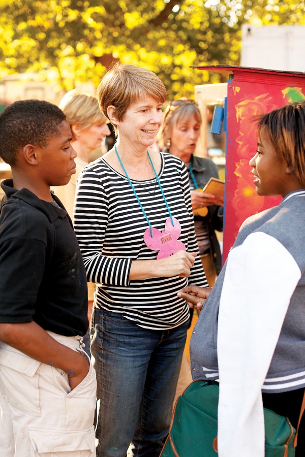
Erin Harris with kids at the Carpenter Art Garden in Binghampton

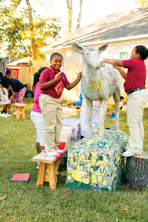
It’s 4 p.m. on a Tuesday afternoon, and about 40 elementary-age kids are working on art projects — some are painting pumpkins, others are adding mosaic tiles to a horse sculpture — in a once-blighted lot on Carpenter Street in Binghampton.

The lot that was once overgrown with weeds is now lined with colorful murals and dotted with planters made from discarded car tires painted all the shades of the rainbow. There’s a small stage for performers and picnic tables, where the kids are sitting.

Justin Fox Burks

Welcome to the Carpenter Art Garden, a volunteer-run, after-school program that provides children of Binghampton with a creative outlet. They meet here weekly in the lot next door to a boarded-up purple house that’s spray-painted with the words “Property of the Memphis Police Organized Crime Unit.” It’s the perfect juxtaposition of what Binghampton was and what it’s becoming.

For years, Binghampton, bordered by Poplar, East Parkway, Summer, and Holmes, has suffered from blight, crime, poverty, and a perception problem. But thanks in part to the success of the neighborhood’s Broad Avenue Arts District, plans for the Hampline (a two-way bicycle lane through the neighborhood connecting with the Shelby Farms Greenline’s entrance on Tillman), and the work of the Mayor’s Innovation Delivery Team and Community L.I.F.T. (a neighborhood revitalization program that connects projects with funding sources), the area has been getting more positive attention from outsiders.

Meanwhile, groups within the neighborhood — the Binghampton Development Corporation (BDC), the Lester Community Center, Caritas Village, the Refugee Empowerment Program, etc. — have been working hard for years to clean up the blight, provide positive outlets for the residents, and take back the neighborhood without gentrifying or sacrificing its character.

Crime has gone down slightly, with 581 part-one crimes (assaults, burglaries, robberies, rapes, and the like) last year, versus 746 in 2002. And the blight is a little harder to find these days; the BDC has renovated 78 housing units in the past 10 years.
Justin Fox Burks

But if you ask Walter Casey, who has directed the Lester Community Center on Tillman for 33 years and grew up in the neighborhood, the biggest change isn’t something that can be measured in statistics.

“The biggest change I’ve seen is the attitude of the people. They come into the center now, and they’re really positive. They want more educational classes and family-oriented classes,” Casey says. “And I’ve seen the change when strangers are in the neighborhood, riding their bikes or walking or running. At one time, there was fear in their hearts. Now there’s no fear.”

Broad’s New Face

On a Saturday afternoon in early November, small groups lounge and sip from pint glasses of craft beer on the patio of Wiseacre Brewing Co., a new brewery and taproom in a restored warehouse just west of the railroad tracks that cross Broad Avenue.

A few blocks away, guitar aficionados sip wine at the grand opening of Guitar Spa, the latest installment of the Innovation Delivery Team’s MEMShop program. There, craftsman Kevin Ferner will build, sell, and restore custom guitars.

Throughout 2013, Mayor A C Wharton’s team has helped entrepreneurs open five pop-up retail shops and art galleries in once-vacant Broad properties. One more pop-up shop, a photography studio, will open before the year’s end.

“We give them free or reduced rent for the first six months to help them offset their start-up costs, and they receive business technical support from alt.Consulting,” says Abby Miller, project officer for the MEMShop program.
Justin Fox Burks

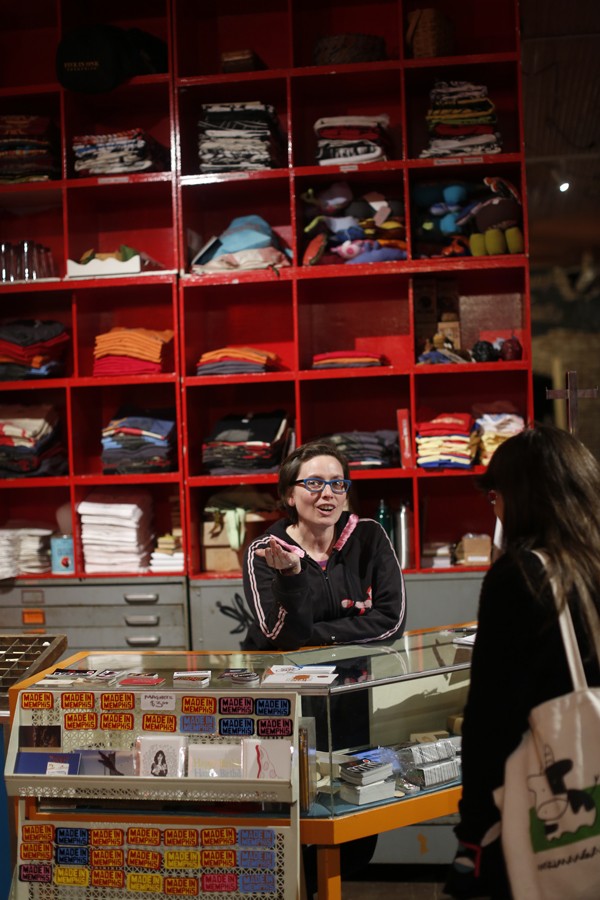
Alice Laskey-Castle at Five-in-One social club

Three of the five pop-up shops — Five-in-One Social Club (an art-class and retail space), My Heavenly Creations (purveyor of homemade bath and beauty products), and NJ Woods Gallery and Design (an art gallery) —have already signed long-term leases with intentions to operate on the street permanently. Another, Indie Style Market (seller of locally made crafts), is still working on its six-month MEMShop lease.

“We really love this space, and we’d wanted a storefront for a long time,” says Alice Laskey-Castle, co-owner of Five-in-One. She and partner Michael Andrews previously operated an art studio and social club in Crosstown. “I love that we have so many artists and craftspeople on the block. There’s a real energy to make Broad the place to go.”

The revitalization of Broad Avenue, once a ghost town of vacant storefronts, has been under way since about 2007, as artists and gallery owners began to relocate to the area with an eye on transforming the street into a thriving arts district.

David Wayne Brown, president of the Historic Broad Business Association and owner of advertising agency Splash Creative, moved his office into the area in 2007. He admits things were rough at first, but he’s seen a shift in crime along Broad.

“When I first moved in, we had two incidents where rocks were thrown into our front windows, and people broke in. But we haven’t had anything happen since. From talking to the Tillman police station, I know it’s absolutely true that crime has gone down,” Brown says.

The strip took off after the groundbreaking “New Face For an Old Broad” event in 2010, a two-day arts festival for which business owners created their own DIY bike lane.

Today, there are only a few vacant spaces left on Broad. The Cove, Jack Magoo’s Sports Bar & Grill, Three Angels Diner, and Broadway Pizza provide the nightlife and dining scene, while galleries and art studios such as T Clifton Gallery and Found host art openings and events. Tattoo artist Babak Tabatabai is preparing to open his shop, Ronin Design and Manufacturing, soon, and Muddy’s Bake Shop uses a Broad storefront for extra kitchen space to bake cupcakes.

Last November, Marcellus Harper opened Collage Dance Collective, a dance school aimed at teaching ballet to children of every income level, in a vacant warehouse space on Broad. Harper’s students come from all over the city, but a few come from the residential area of Binghampton located a few blocks away.

“We have students who walk here from the neighborhood, and we want to increase those numbers,” Harper says.

The Historic Broad Business Association hosts seasonal art-walk events, with the latest one scheduled for Friday, November 8th. More than 70 artists will be exhibiting at 30 locations along the street. The Mighty Souls Brass Band and the Collage Dance Corps will perform on the dock of the warehouse across from the commercial strip.

In a matter of months, that dock will be transformed into an amphitheater for live performances, thanks to a grant by ArtPlace America.

The UrbanArt Commission has placed a call to artists, ending November 8th, to create an art installation on Broad’s iconic water tower. And a crowd-sourced fund-raising campaign, through IOBY.org (IOBY stands for “in our backyards”), has been launched to raise $50,000 toward the $4.4 million Hampline bike lane. As of press time, $27,000 had been raised at ioby.org/project/hampline.

Construction is planned to begin late next summer on the Hampline, the city’s first two-way bicycle track, which will connect Overton Park to the Shelby Farms Greenline on Tillman. Once complete, the bike lane will be buffered from traffic with medians.
Justin Fox Burks

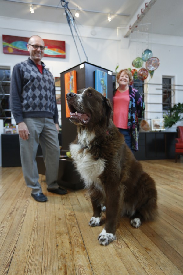
Tom Clifton, Pat Brown, and Argus at T Clifton Gallery

“We’re excited that it will break down the perceptions of Binghampton,” says Pat Brown, co-owner of T Clifton Gallery and vice president of the Historic Broad Business Association. “There are families living on Tillman, and we’re excited that people from outside the neighborhood will better get to know that part of Binghampton.”

Taking on Tillman

The Hampline will turn south at Tillman Street from Broad, taking cyclists through one of the main arteries of residential Binghampton, a street once characterized by blighted apartment projects and a dangerous reputation.
Justin Fox Burks

Kitty Woodland

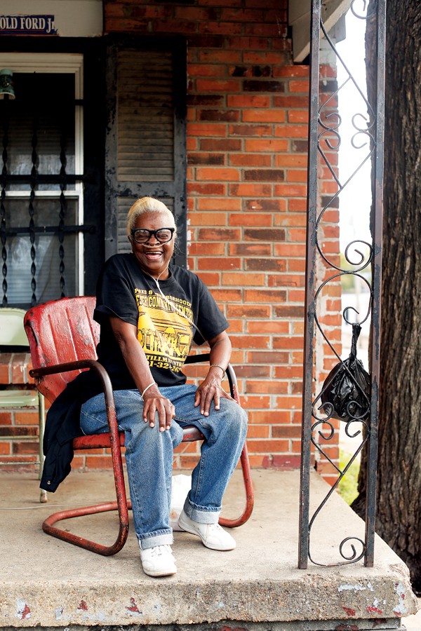
It’ll go right past the Tillman Street apartment of Kitty Woodland, a spunky senior with long, bleach-blond hair. Woodland has lived in Binghampton for 60 years, and she’s seen the area change from good to worse to good again.

“It used to be so quiet, and everybody knew each other. We didn’t hardly have no violence or nothing going on. But a lot of people moved away. Ain’t too many people my age still around here,” Woodland says.

Though the area went through a rough patch a decade or so ago, Woodland says she sees things changing, thanks in part, she says, to the blight removal work of the BDC, which celebrated 10 years in 2013.

“They [the BDC] came to my house and did some work in 2007, because the house was so old. We didn’t even have lights in the ceiling. We just had lamps. But they came through and fixed the roof and wired my house with lights,” Woodland says.

Woodland’s house is near a new youth football field called the Hamp. The BDC purchased and demolished an aging apartment complex to make way for the field. Volunteer coaches from Memphis Gridiron Ministries organized a football team, the Binghampton Bulldogs, which kicked off its first season last summer.

Justin Fox Burks

Wade West (top row, second from left) of Memphis Gridiron Ministries and his players and coaches

On a recent Tuesday afternoon, about 40 third- and fourth-graders from Binghampton posed for pictures in football uniforms donated by Nike. They took a few serious shots before the photographer said, “Do a goofy face.” The energetic boys giggled as they stuck out tongues and threw peace signs. As soon as the session was over, they broke up and started running chaotically around the field.

“Many of the teams we play are from suburban, private schools, so we are bringing suburban Memphis into urban Memphis and urban Memphis into the suburbs,” says Wade West, founder of Memphis Gridiron Ministries. “One of the biggest problems in our city is the lack of understanding between the black population and the white population. We’re trying to change that mindset.”

In its 10 years, the BDC, led by Robert Montague, has invested $10 million in property improvements and programs like the Hamp field. They’ve renovated 78 housing units, sold 31 properties, with seven additional lease-purchase deals, and constructed 14 new homes with the help of Binghampton residents, who learn construction skills.

“When I give a tour of the neighborhood now, it’s harder to find the abject blight. It’s still here, but it used to be pervasive,” Montague says. “Some of the arteries had the most hideous properties. Our strategy is to go after the worst and most impactful. Tillman is a big artery, so we went after some big apartment deals there.”

Last year, the BDC gave the Tillman Crossing complex, which overlooks the Greenline’s entrance, a makeover with fresh paint and renovated apartments. When the Greenline first opened, critics complained about the graffiti-stained, abandoned complex. Now it’s full of tenants, including the Greenline ranger office.

Across the street from the Greenline, the BDC cleaned up an overgrown lot and installed a public park.

But the BDC’s work extends beyond Tillman. Deep inside Binghampton on Carpenter Street, they assisted former art teacher Erin Harris in purchasing and cleaning up the overgrown lot that now serves as the Carpenter Art Garden.

“This offers kids the art they’re not getting in school, but more importantly, they’ve all become much better friends,” Harris says. “They’re like a little family now. We’ve had kids whose parents want to move out of the neighborhood, and the kids say no. They don’t want to leave the community of the garden.”

The kids and Harris’ team of volunteers have taken their art beyond the garden in recent weeks, painting colorful murals on the sides of businesses along Tillman.

Harris is working with the BDC to acquire and rehab the purple boarded-up house next door and turn it into an art studio and computer lab. A few plots down, she also worked with the BDC to create a community garden.

Additionally, the Mayor’s Innovation Delivery Team and Community L.I.F.T. have turned their attention to Tillman. They recently pushed the Inner-City Economic Development initiative, which provides forgivable loans to Binghampton business owners to make improvements to their storefronts, through the Memphis City Council.

Sonda Chapman, owner of the Timesaver III convenience store on Tillman, is hoping to be approved for one of those loans.

“I should try and get my parking lot fixed. It’s raggedy. I’d also like to fix up one of the [vacant] buildings next door so I can rent it out,” Chapman says.

The West Village

Due to barriers like Sam Cooper Boulevard and a set of railroad tracks cutting through the neighborhood, Binghampton is essentially split into separate communities.
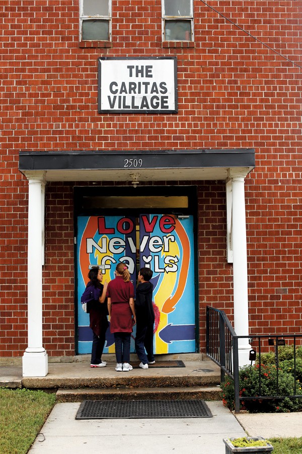
The Caritas Village in Binghampton offers multiple programs for the residents

Nothing exemplifies the west side, between East Parkway and Collins, better than the Caritas Village, a nonprofit coffee shop and cultural center that aims to “break down walls of hostility and build bridges of love and trust between the rich and those made poor,” according to founder Onie Johns.

Each day, Caritas Village offers programs ranging from art and dance classes and poetry readings to Bible study and yoga. There’s a free medical clinic for Binghampton residents on Tuesdays. Many of the programs are aimed at the area’s large Hispanic population.

They also serve coffee and breakfast in the morning and burgers and sandwiches at lunch every day, attracting diners from across the city.

Johns, who last month received the AARP’s most prestigious volunteer award, moved from Germantown to Binghampton in 2000, after she says she received a religious calling to work in an inner-city neighborhood.

“Back then, my best friend said she couldn’t come see me in this neighborhood because she was afraid to bring her car into the area,” Johns says.
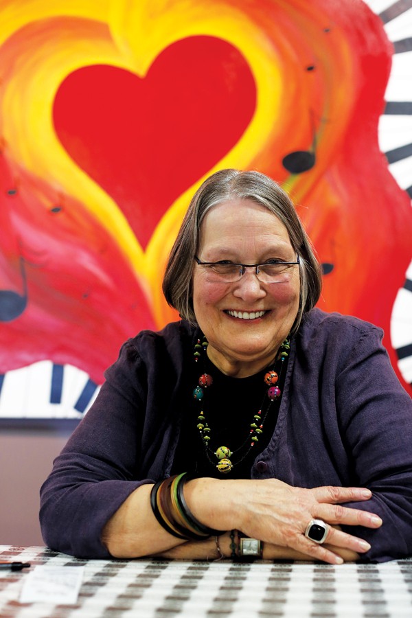
Onie Johns, Caritas Village founder

Johns admits that even she was unsure what she’d face once she moved her life to Binghampton.

“It’s not near as scary when you get to know the area. When I used to drive in from Germantown, I thought it was the most deprived area I’d ever seen. Now I sleep here every night,” Johns says.

A few blocks away, Amy Moritz runs the Center for Transforming Communities, a collection of nonprofits that includes homeless service provider Door of Hope, the McMerton Community Gardens, Binghampton United Methodist Church, and Holy Pentecost Church (where refugees from the African country of Burundi hold services in their native language).

“I have some distinct memories early on in my tenure here of people meeting me for service work on the building and saying, ‘Aren’t you afraid to work here?'” Moritz says. “But this is a positive place with positive energy.”

One of the programs at the center, the Refugee Empowerment Program, provides educational classes to Binghampton’s large refugee population. People from 18 countries, including Somalia, Sudan, Ethiopia, Iraq, and Burma, take English as a Second Language courses there.

Anthony Gilbert, a violinist, rents studio space at the Center for Transforming Communities and lives in the community as well. He moved to Binghampton in 2011, attracted by inexpensive rent and diversity.

“As an artist, I can live so cheaply here, which is great for my music. My rent is less than some people’s bills at Whole Foods,” Gilbert says. “I don’t have to work 40 hours a week or have another job. I can just hustle and play my gigs.”

Gilbert teaches affordable violin lessons to Binghampton residents, and he has visions of starting a music school at the center.

Johns admits that plenty of work still needs to be done to improve the lives of many of Binghampton’s low-income residents. But through her work, she sees the community becoming stronger as more people begin to work together.

“It’s so rich with relationships that you forget the deprivation that is here,” Johns says.

Broad Effects

Although community activists such as Johns and Montague with the BDC have been working in Binghampton for years, outsiders’ perceptions of the area as dangerous have only recently begun to shift.

While numerous factors come into play, the fact that cyclists and joggers now must cross Tillman to access the Greenline entrance has likely played a big part in breaking down barriers. Art events on Broad that attract people from all over the city have also played a role in the larger Memphis community embracing Binghampton.

“So many people came to ‘New Face For an Old Broad’ [in 2010] because they knew what a terrible reputation Broad had, and they were curious as to what the hell we were doing,” says Tom Clifton of T Clifton Gallery.

“Now they feel like they’re a part of it and are partially responsible, and that bleeds over into Binghampton as a whole. They want the whole area to succeed because of what they’ve seen happen on Broad.”

Pat Brown of T Clifton admits there’s work to be done in bridging the gap between Broad and the residential neighborhood south of Sam Cooper Boulevard. She says they’re trying to get more Binghampton residents to utilize the services and visit art events along the street.

“A large percentage of Binghampton residents are pedestrians, and Sam Cooper is a barrier to some. But we realize to be successful, we have to engage the community,” she says.

Over the past several months, the Mayor’s Innovation Delivery Team has held monthly Night Market events, where artists and craftspeople peddle their wares in a parking lot on Broad. The Historic Broad Business Association has held focus groups before the markets, making sure to include the residents, inviting them to be vendors.

Johns, who offers art programs at Caritas, knows firsthand that it can be difficult to get residents interested in art.

“For the people in the neighborhood who are struggling to get by, art is just not their thing,” Johns says. “When we first started doing art workshops here with the kids, it was really difficult to get them to come.”

But Montague says that attitude is slowly changing.

“The early art walks were more homogenous and not of the neighborhood, but the last art walk was extremely diverse,” Montague says. “I hope more and more Binghampton folks physically connect on Broad — eat there, shop there, go to the stage on the loading dock. I think the amphitheater [on the warehouse loading dock] will draw more people there.

“There were tumbleweeds going down Broad when we got here 10 years ago, and there was prostitution and gambling,” Montague continues. “Broad has had an indirect, very positive effect on the people of Binghampton.”